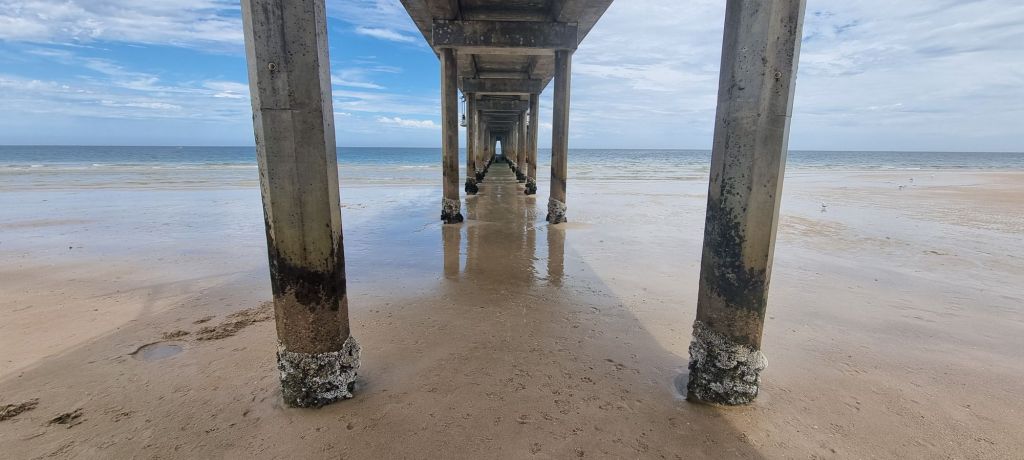
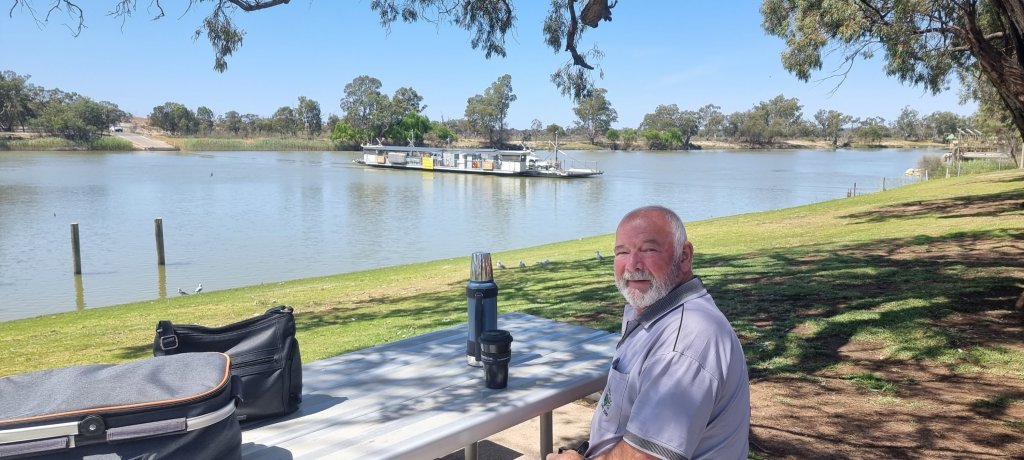
2024 is the 16th anniversary of the Brighton Jetty Sculptures Exhibition (South Australia), and the third time we have been since 2019.
The Exhibition is the initiative of the Brighton Surf Life Saving Club. They were inspired by the “Sculptures By The Sea” at Cottesloe Beach in Western Australia. We have been many times to the Cottesloe event as we are originally from W.A.
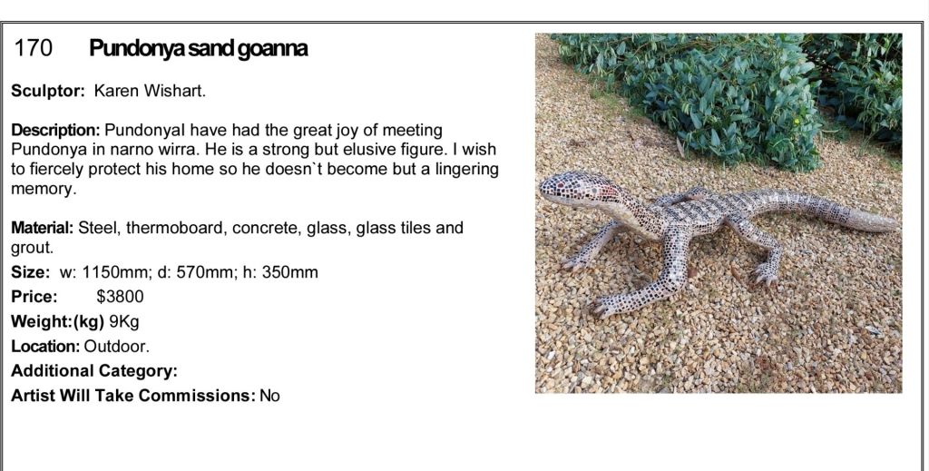
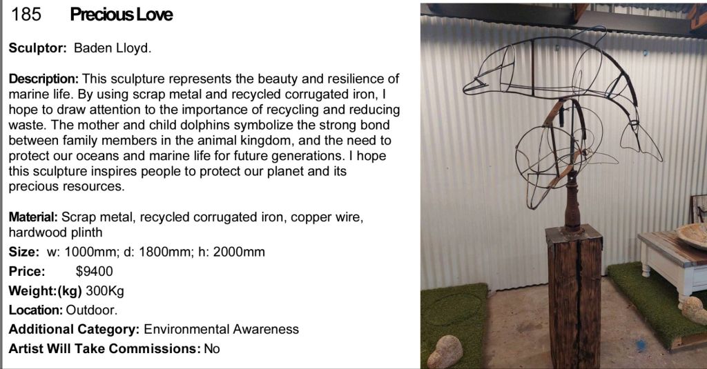
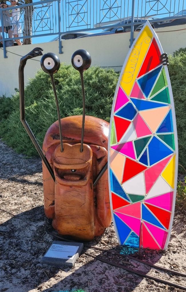
The event helps promote local artists and give them an opportunity to showcase their works. The artwork is for sale, plus most of the artists are willing to take on commissions for individual pieces.
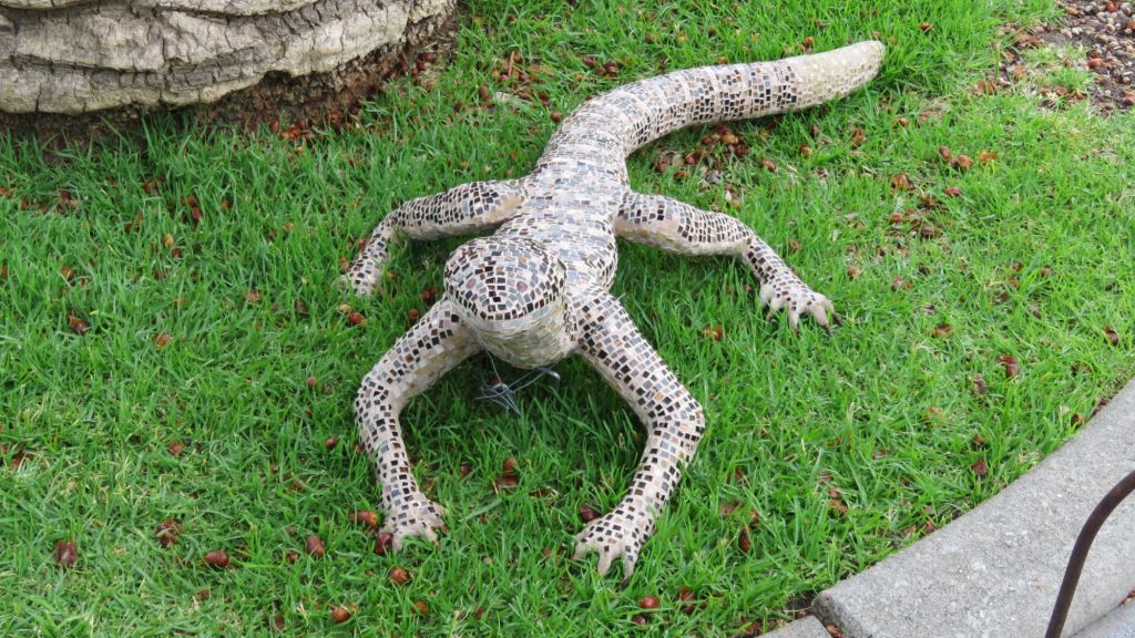
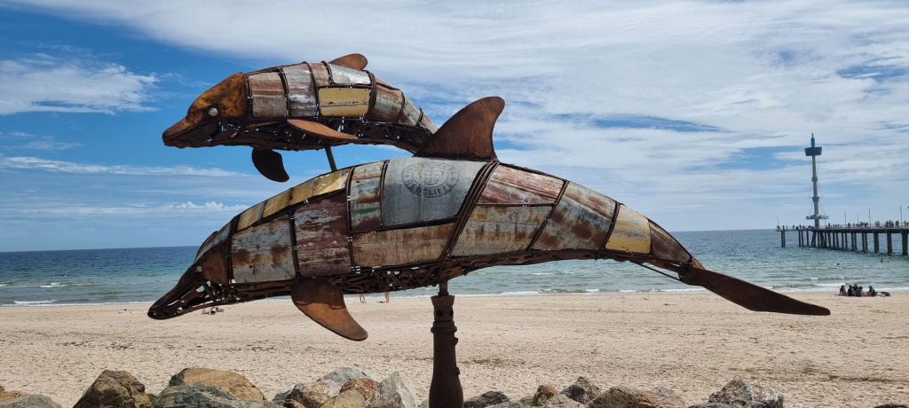
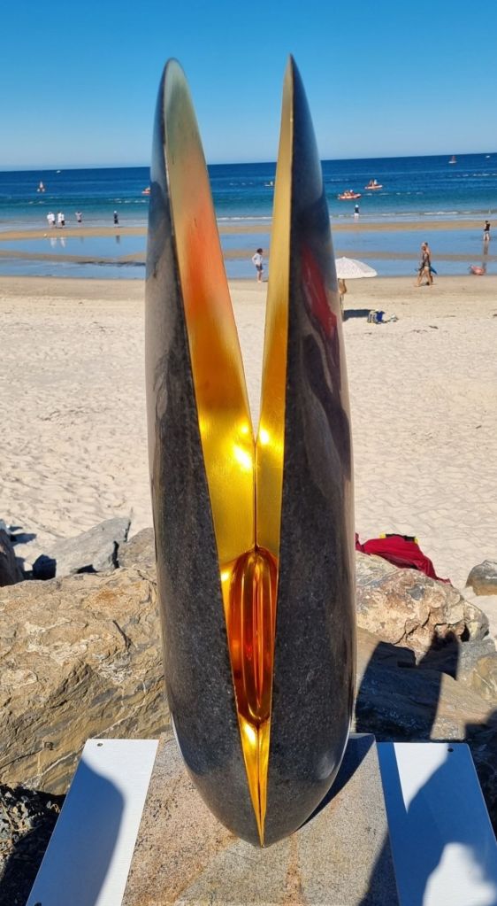
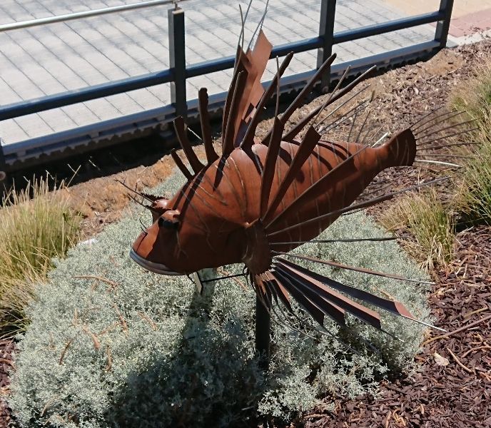
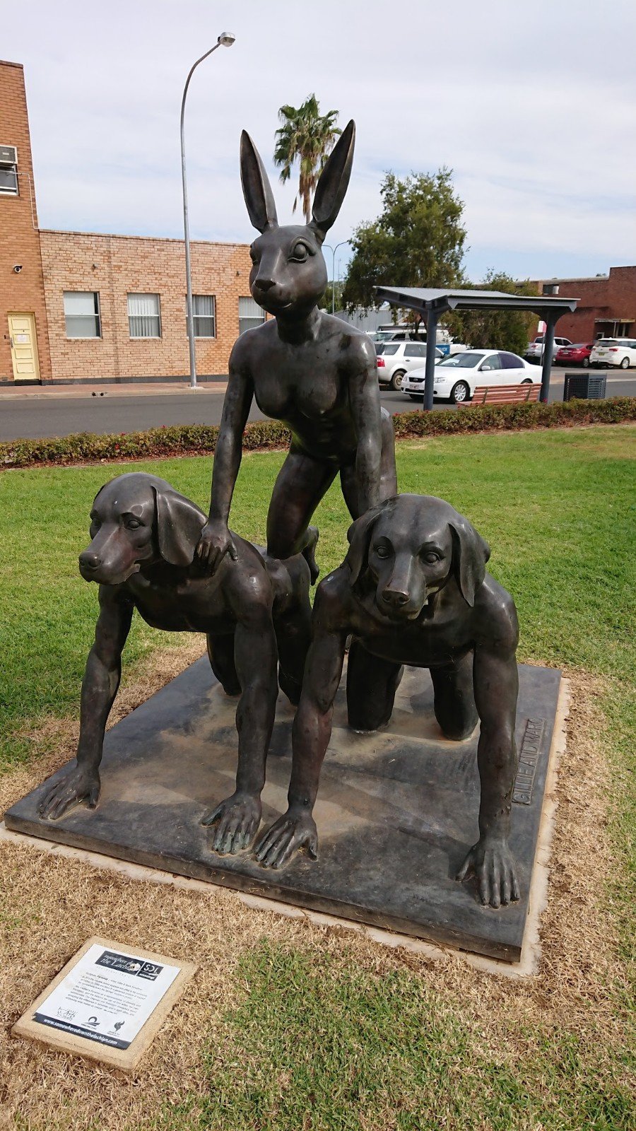
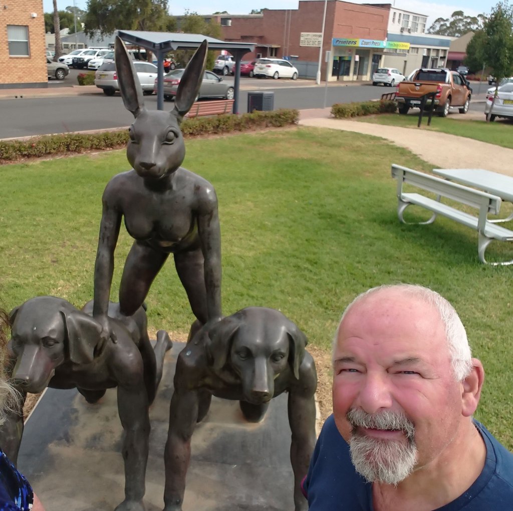
These last 5 pics are from previous exhibitions in Brighton.
Check out our video below, which gives an overview of what we saw on two different days in January 2024.
To video or not to video! We have been contemplating the future of our social media postings, particularly uploading to YouTube.
Below is a totally unplanned chat (about our postings) we had recently whilst driving in the car. Let us know what you think. We would value feedback, positive or negative.
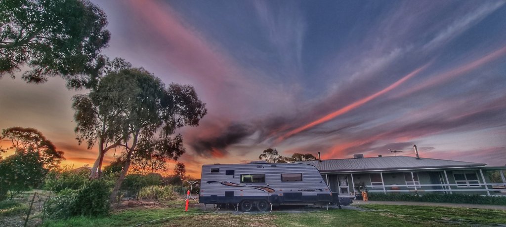
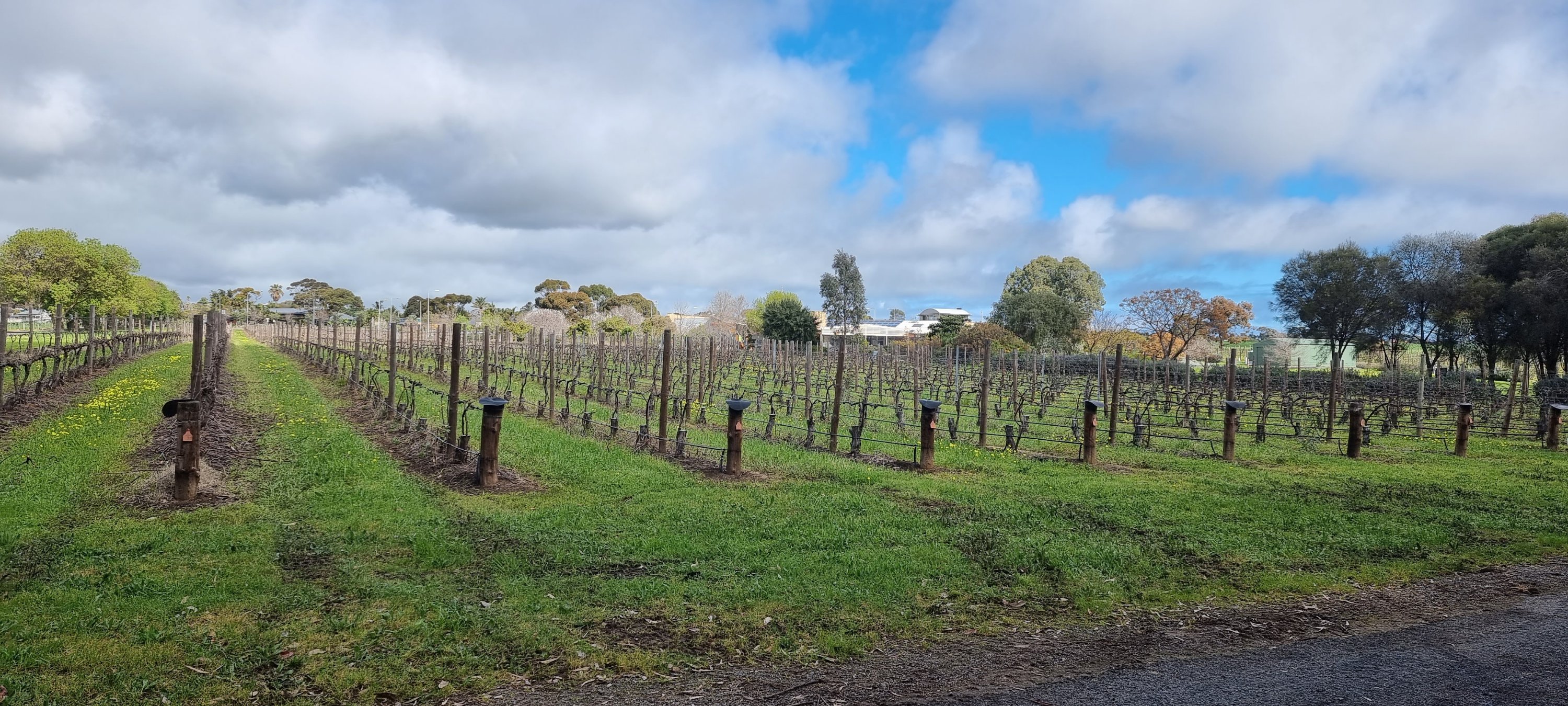
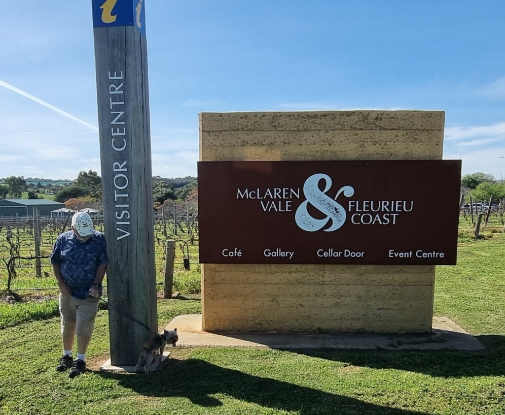
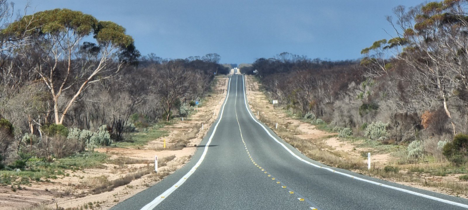
It has been some time since we last wrote on our blog. That is primarily because not much of interest has happened over the past six months. Life has been fairly mundane in terms of having anything exciting to share. The whole premise of this blog and the name of it is to share our travels. Since returning from Alice Springs in June, we have been stationary in South Australia, mainly McLaren Vale on the Fleurieu Peninsula, south of Adelaide city.
We are very hopeful that 2024 will be much more exciting with a great deal of travel involved. We have plans A to Z and it will be interesting to see which of those plans actually turn into a reality. One of the biggest lessons to come out of the Covid Pandemic, is never plan too far in advance and be willing to adapt and change at short notice.
Plan A, as of December 2023, is to head back to Alice Springs to the Women’s Musem of Australia for our 5th, and probably final time, in March 2024. We aim to stay three to four months and then head to Western Australia. We haven’t been back since May 2021, and we want to catch up with the family and sort out some loose ends. Not sure how long we will be there, but imagine it will be a couple of months at least. We have a number of ideas about where and what after that, but will keep that to ourselves for now, as it is too far ahead to make any firm decisions.
But back to 2023 and some of the things we have done.
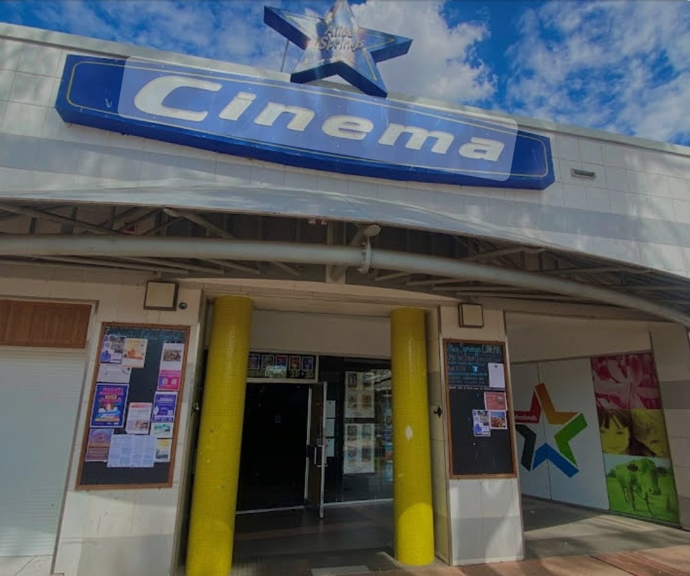
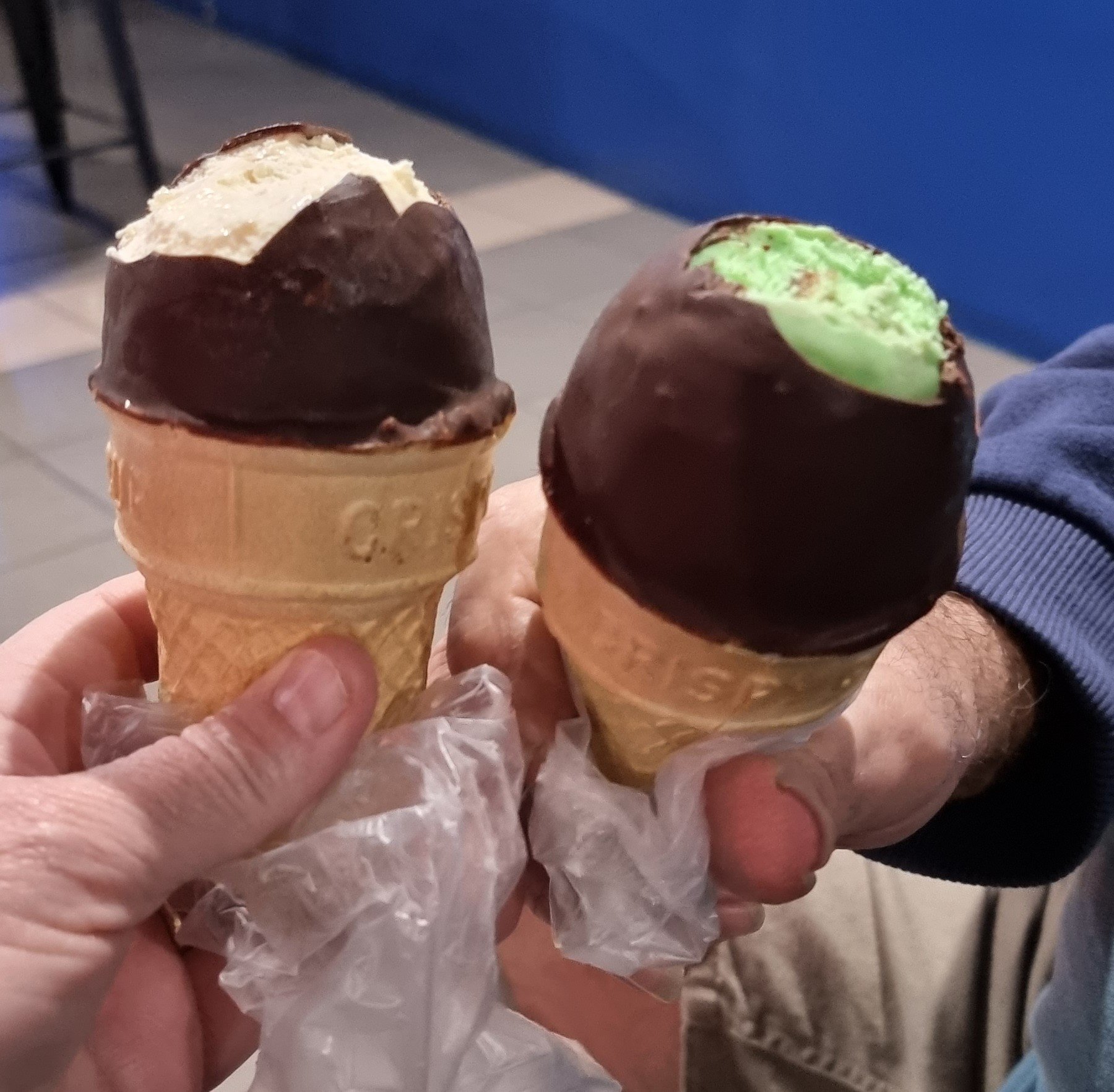
The cinema was an almost weekly event, both in Alice Springs and here in South Australia. Some of the movies we saw, in no particular order, were;
Oppenheimer – Brilliant
Killer of the Flower Moon – Very moving
Napoleon – Thoroughly enjoyed
Leo – Funny
The Marvels – Entertaining
A Haunting in Venice – So so
Nyad – Incredible
Guardians of the Galaxy Vol. 3 – Entertaining
Indiana Jones and the Dial of Destiny – Entertaining
Strays – Hysterically funny
My Big Fat Greek Wedding 3 – Funny
You Are So Not Invited to My Bat – Funny
Book Club: The Next Chapter – Very funny
The Miracle Club – Sad and funny
Mafia Mamma – Very funny
80 for Brady – Funny
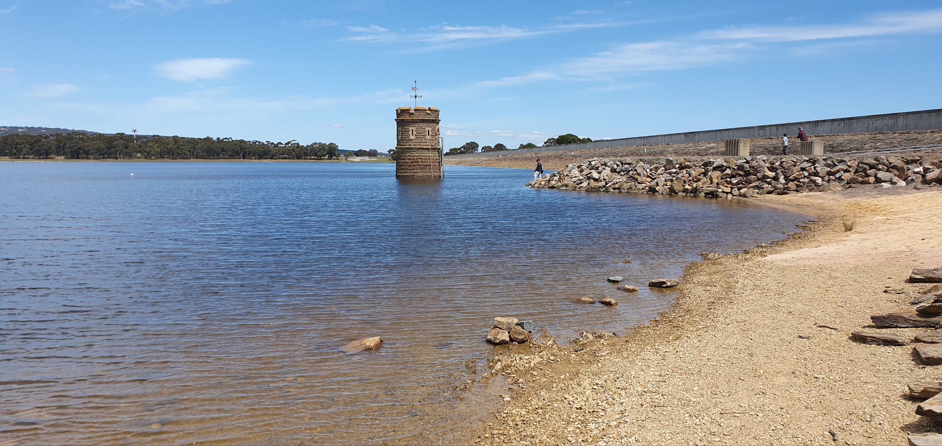
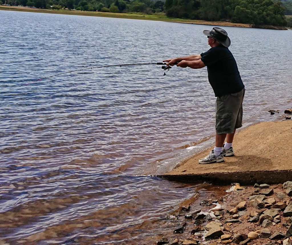
We have both spent time following our individual interests of fishing and photography. Ray has been to a few different places but mainly to two different reservoirs, Myponga and Happy Valley.
Happy ValleyMyponga Raymondo the Fisherman
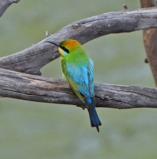
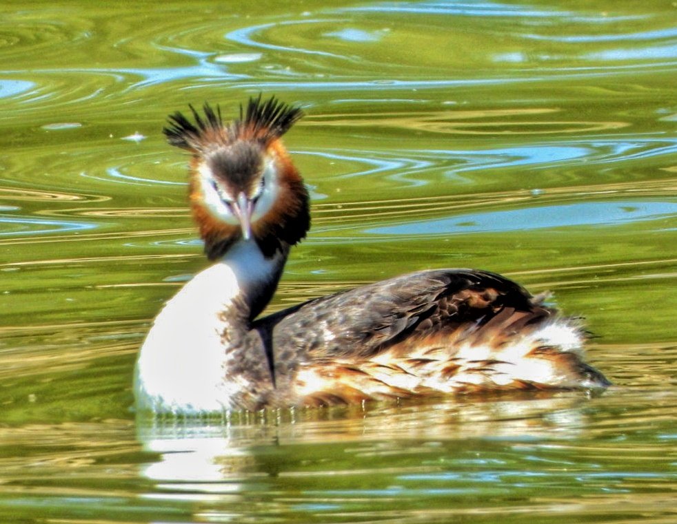
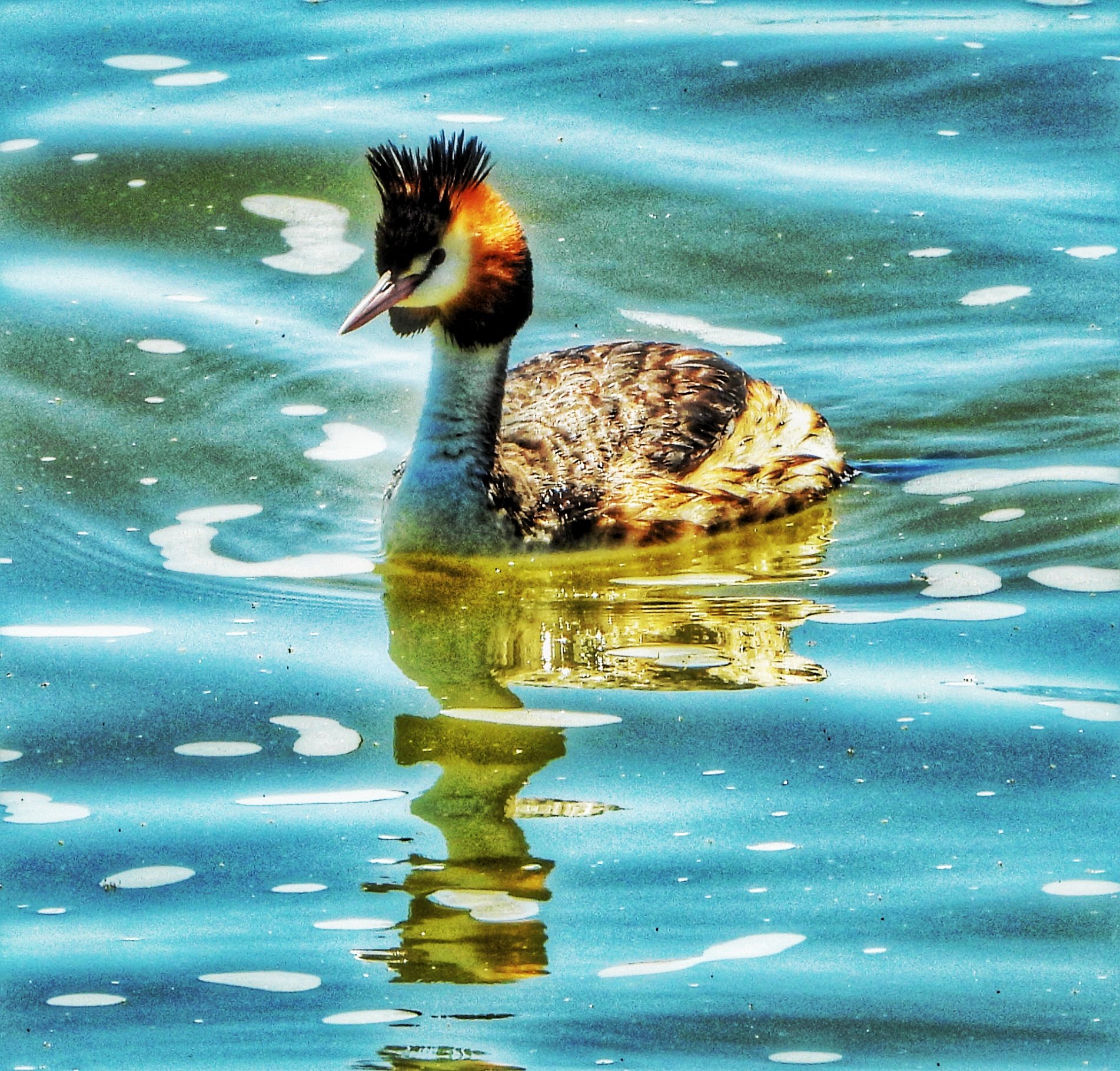
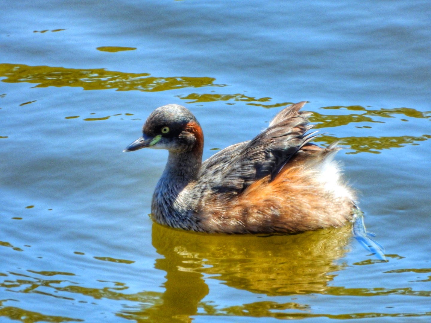
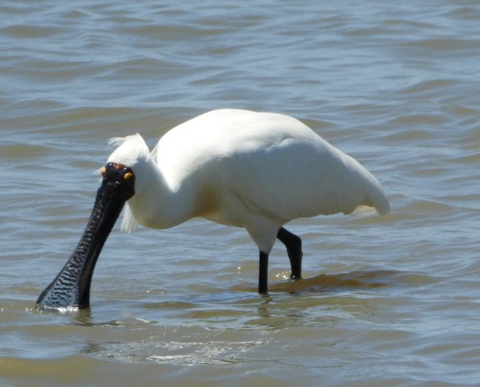
Jude has been focused on finding and photographing birds she has never seen before. Three of those are the Rainbow Bee-Eater, The Royal Spoonbill and the Great Crested Grebe.
Rainbow Bee-Eater
Great Crested Grebe Great Crested Grebe Australasian Grebe
Royal Spoonbill
Royal Spoonbill
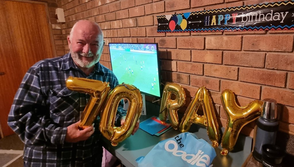
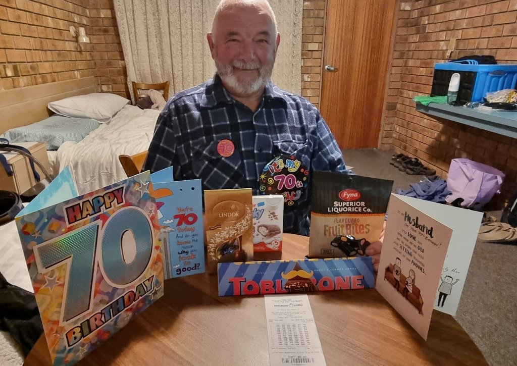
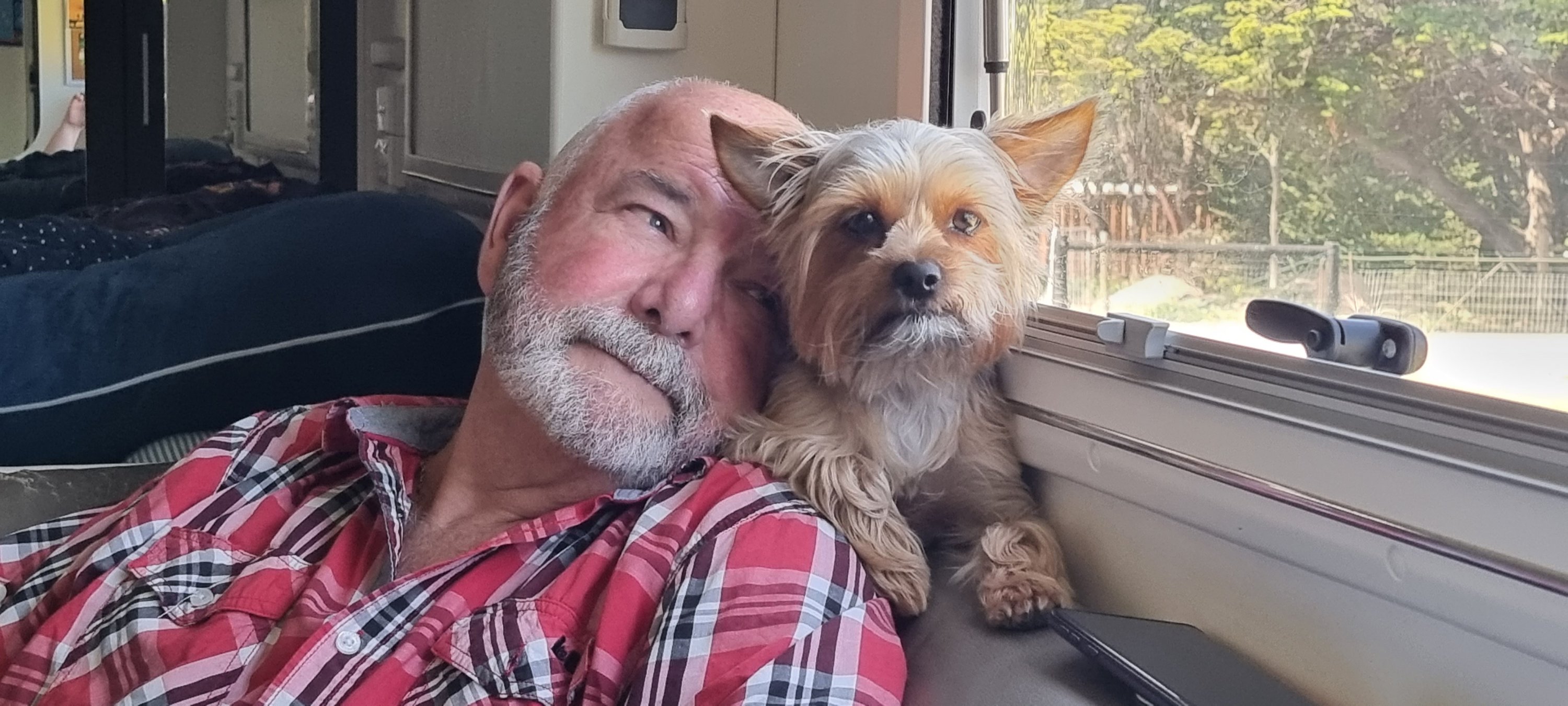
But the biggest and most important event of 2023 was Ray turned 70! He didn’t want a fuss made, and therefore, we had a quiet weekend away in the Riverland town of Waikerie and were able to take Winston with us.
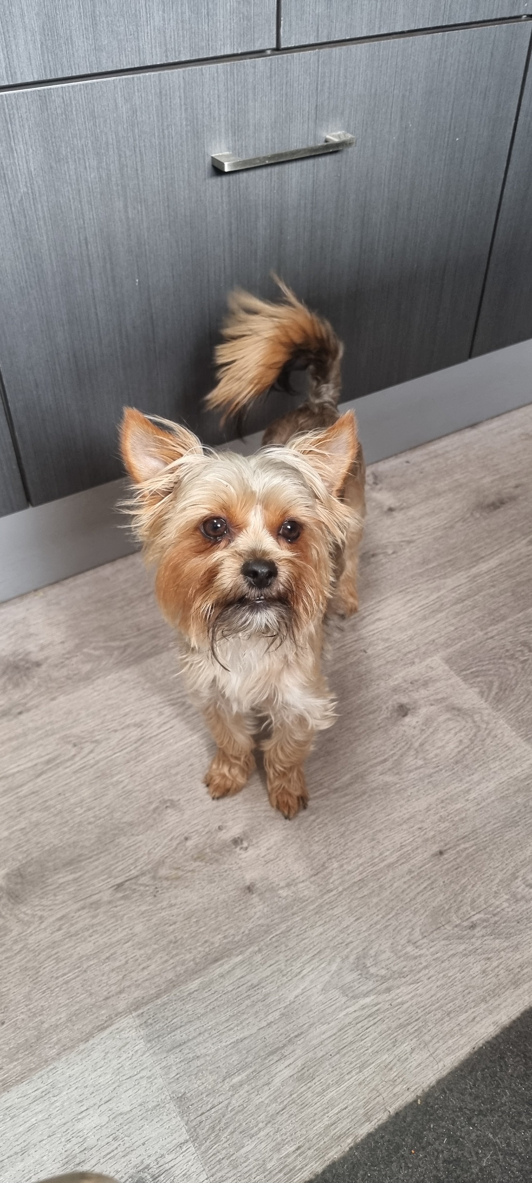
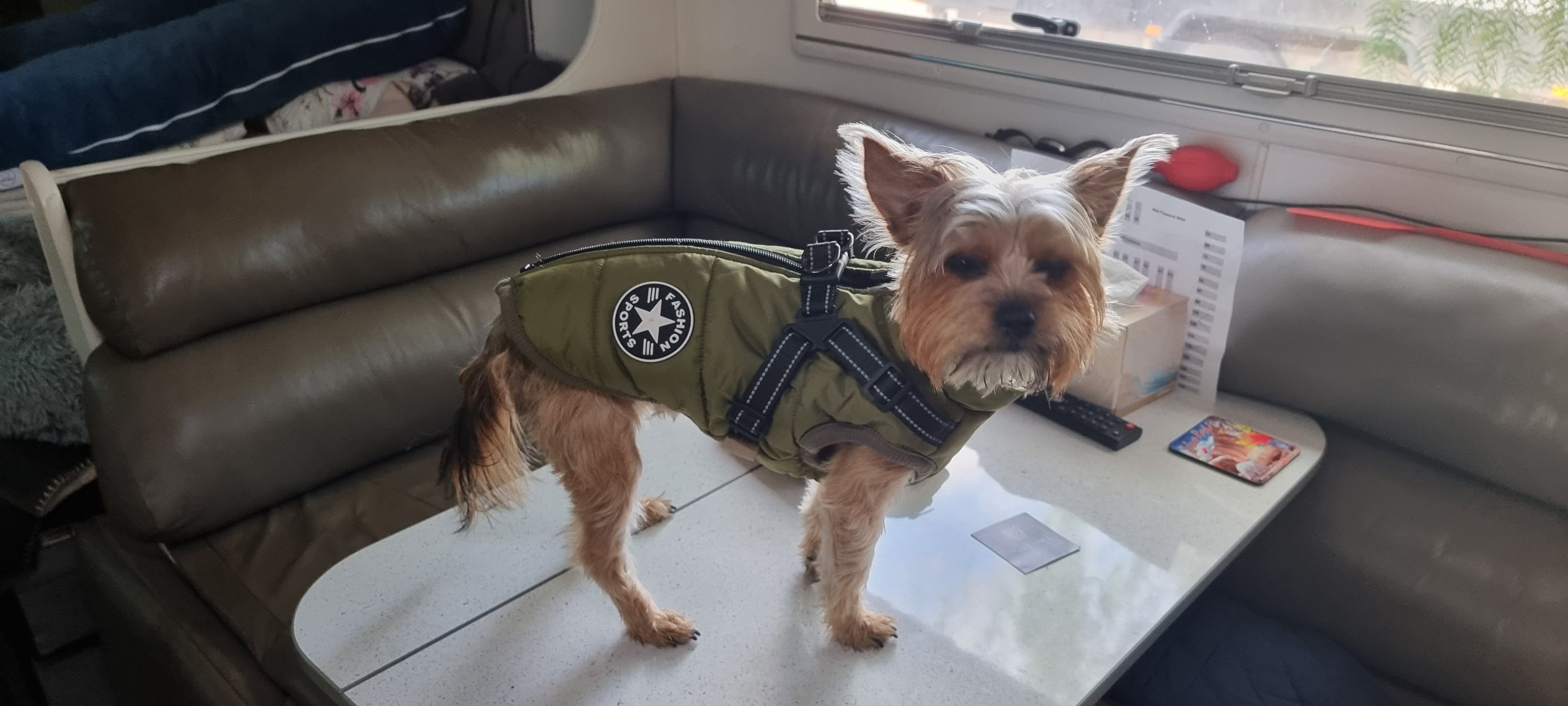
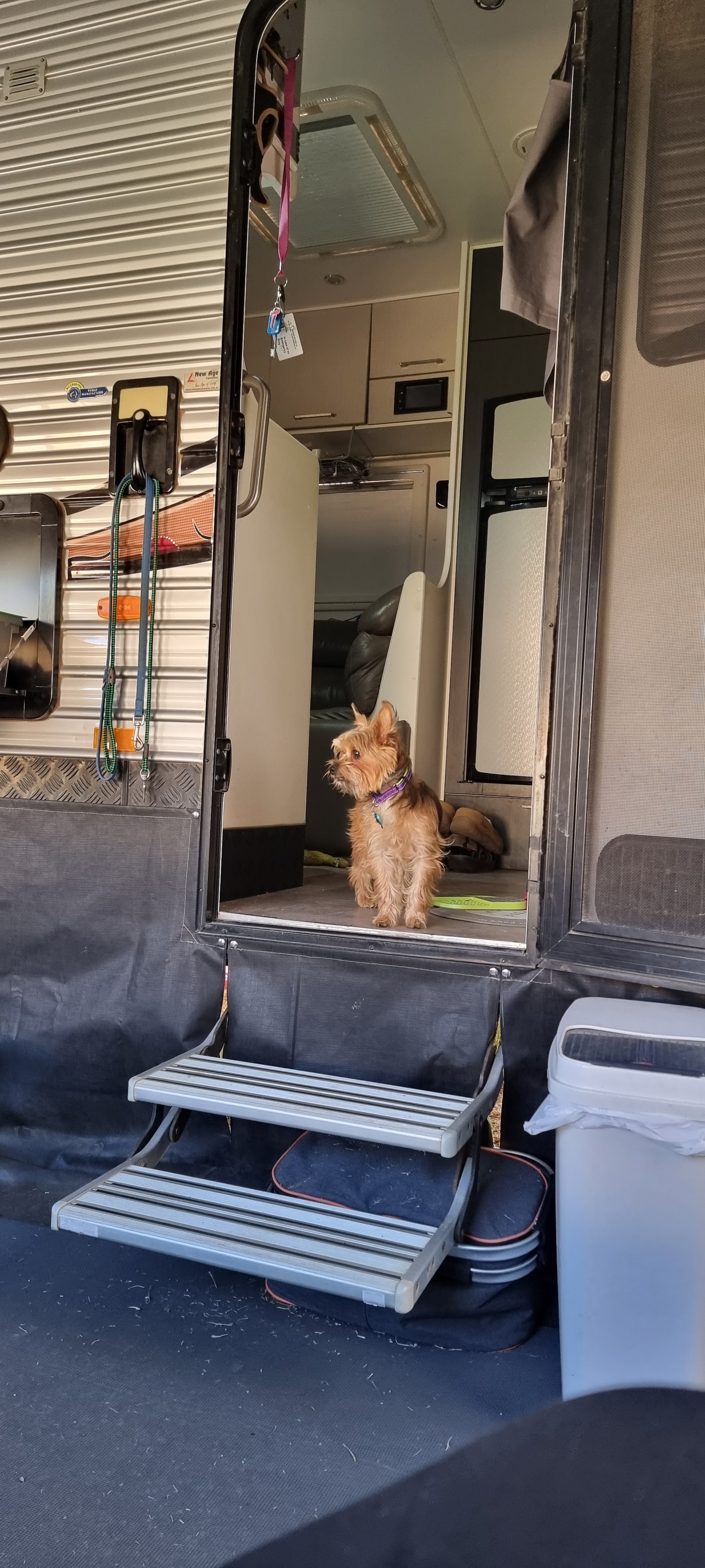
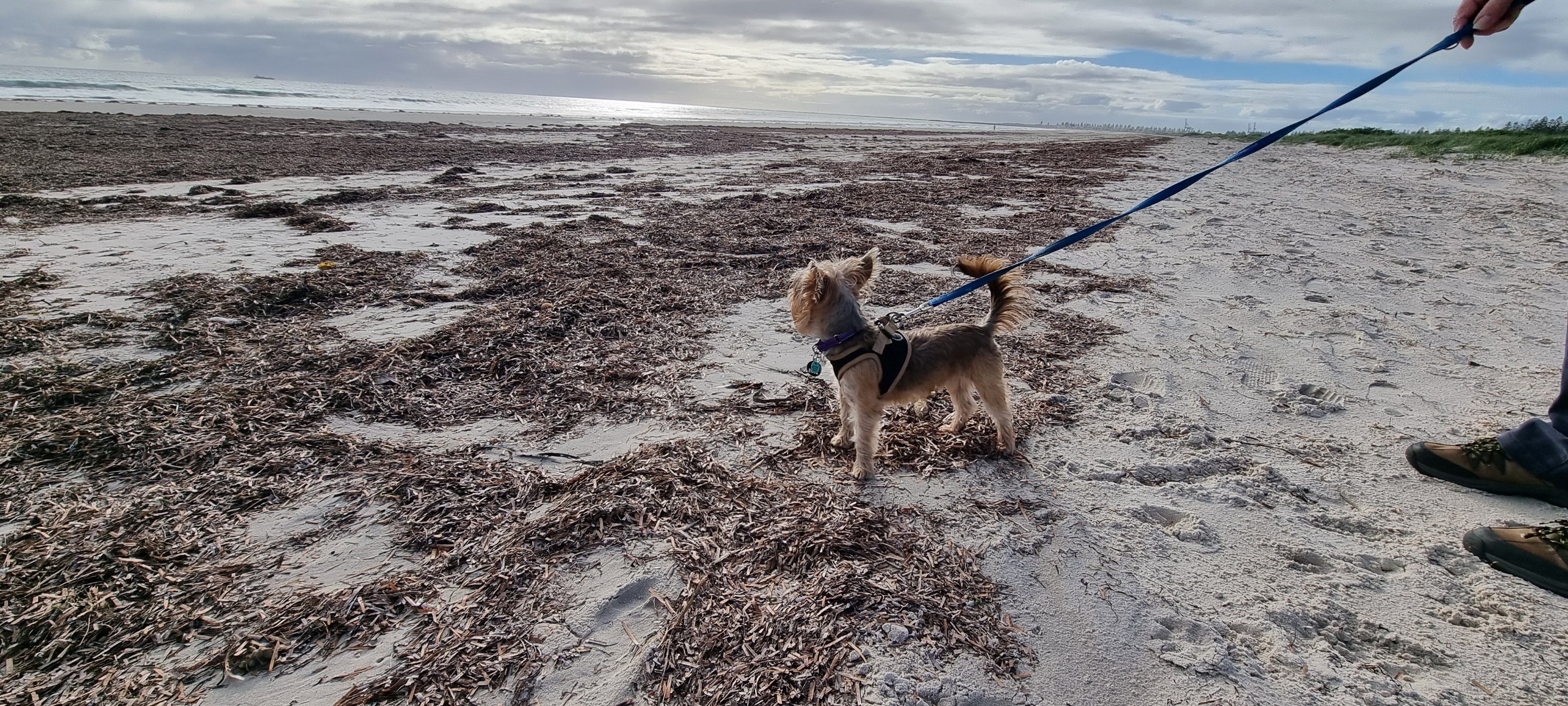
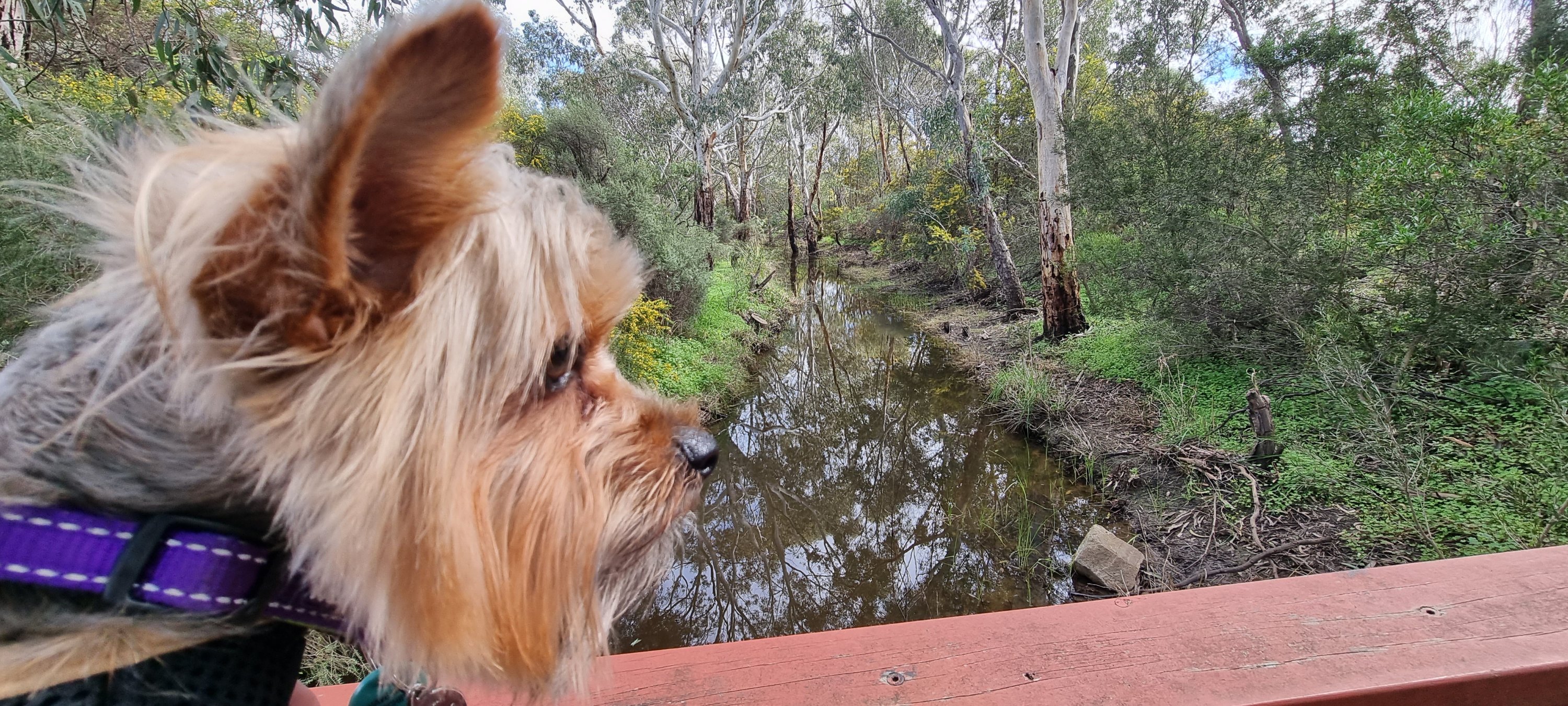
And to finish off, we wish everyone a very Merry Christmas 2023 and every happiness for 2024. We leave you with some pics of Winston who turned one in September.
2016 – 2023 sees us celebrating seven years on the road. It was hard to choose from so many memories, but we went with people, places, pets! Sit back, put your feet up, and enjoy our trip down memory lane! 🙋♂️🙋♀️🐶
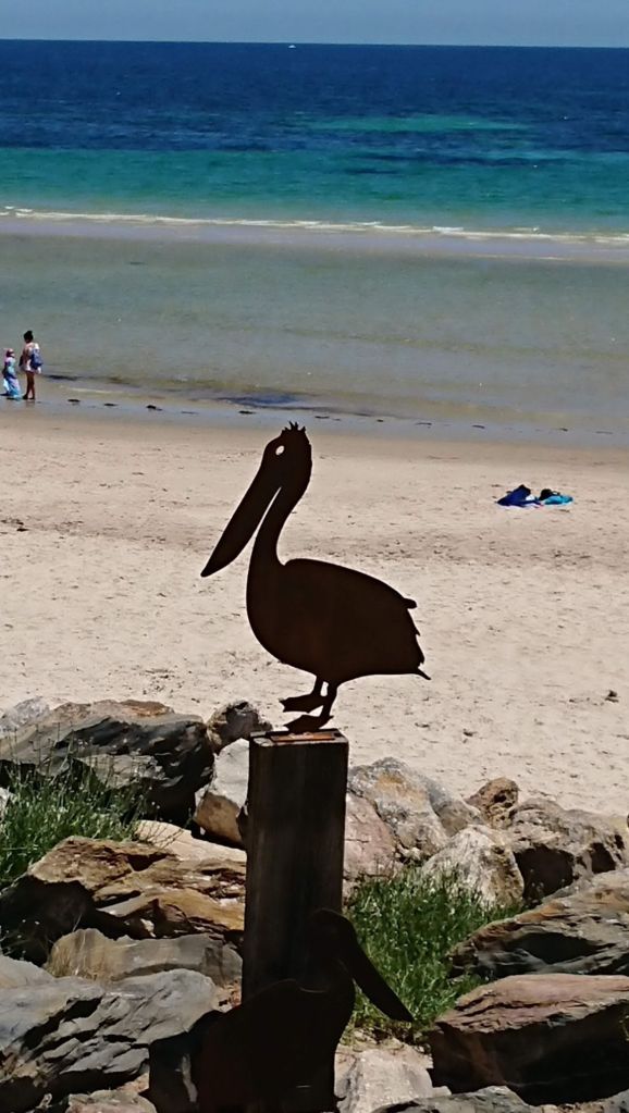
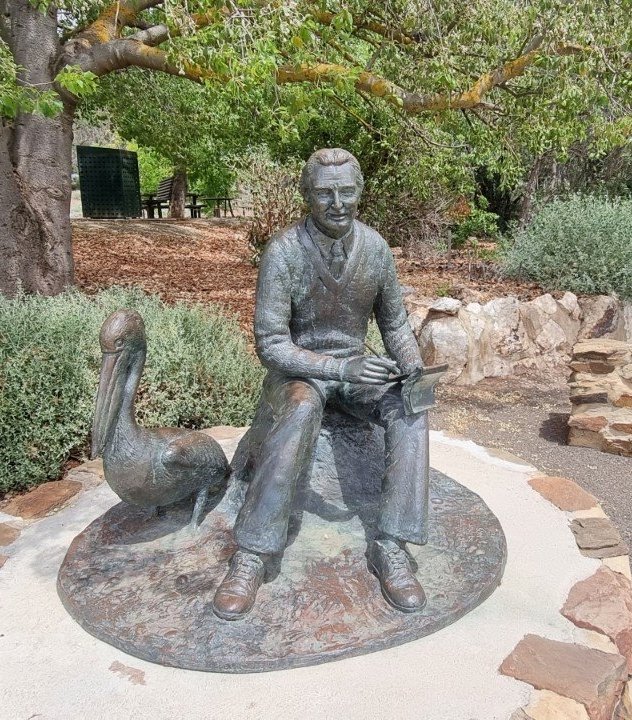
Colin Thiele wrote the 1964 Australian children’s novel about a boy and his pelican. The story was set in The Coorong area of the Fleurieu Peninsula, South Australia. This statue is in Eudunda, the birthplace of Thiele.
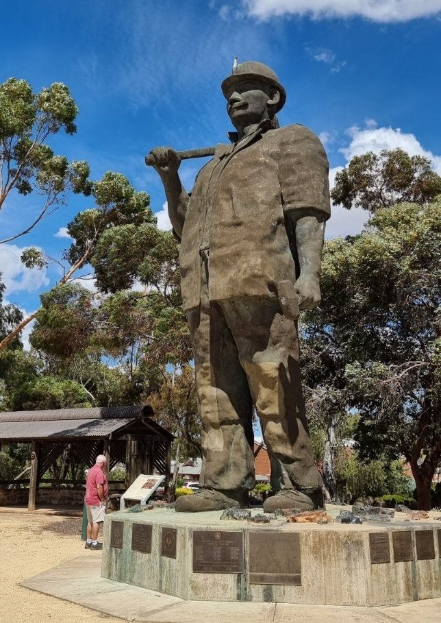
Map the Miner, also known as Map Kernow or the Son of Cornwall, is a 7-metre (23 ft) statue commemorating the Cornish mining history of the town of Kapunda in South Australia. Built by Ben van Zetten, the statue stands to at the southern entrance to the town, and is regarded as one of Australia’s Big Things.
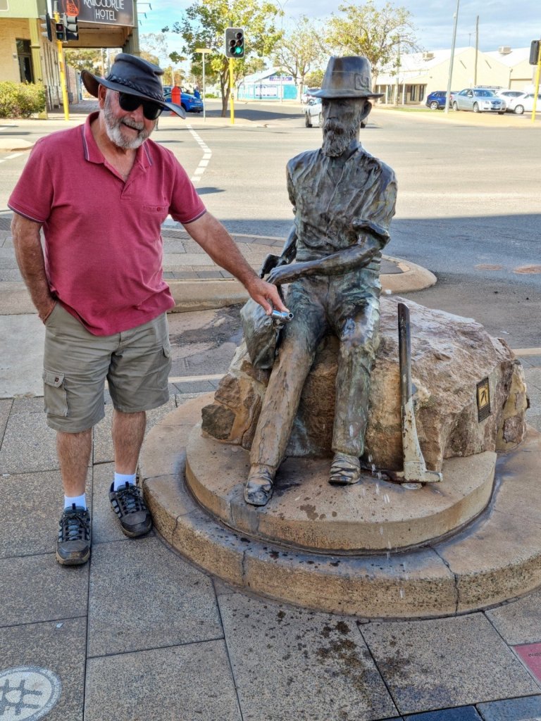
Statue of Patrick “Paddy” Hannan in Kalgoorlie, Western Australia, Australia. Hannan was a gold prospector whose lucrative discovery on 14 June 1893 set off a major gold rush in the area. On the statue Paddy has a waterbag at his side. It has a water tap which Ray has turned on.
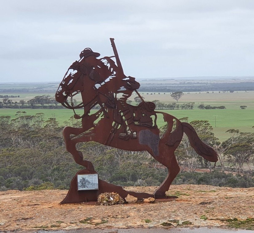
Light Horse Memorial – Yeerakine Rock , Kondinin, Western Australia
The sculpture commemorates the men and animals who sacrificed their lives for their country during World War One. It evokes the memories of local men who were members of the 10th Light Horse Regiment during that conflict.
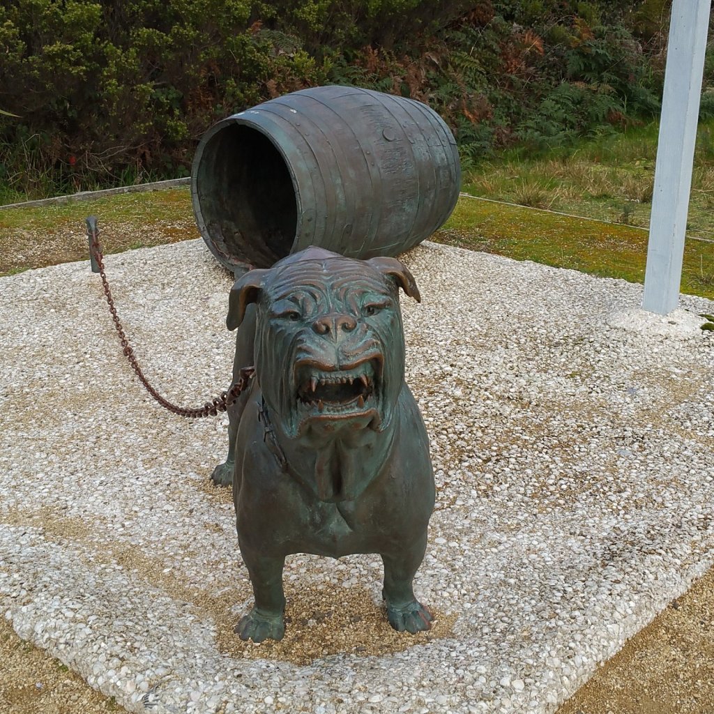
Eaglehawk Neck, Tasmania – during the convict penal settlement days, savage attack dogs were chained from one side of the neck to the other within reach of each other to deter prisoners from attempting an escape by land from Port Arthur. As a sombre reminder of the location’s use, a bronze dog sculpture marks the spot where chained attack dogs were once stationed.
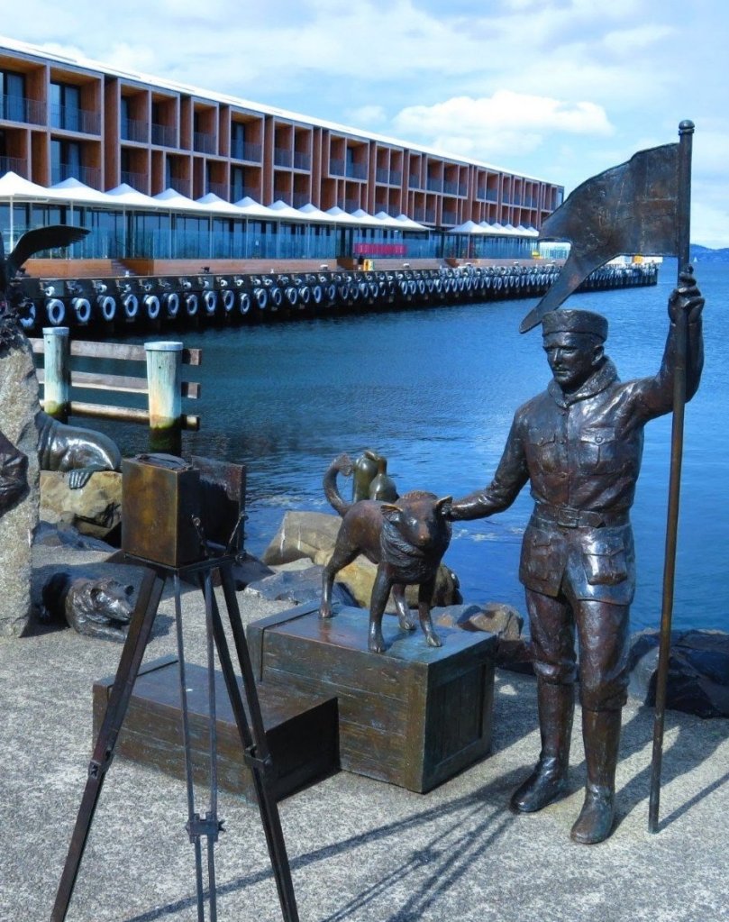
This sculpture, on the Hobart docks, commemorates the Tasmanian Antarctic explorer Louis Bernacchi (1878 – 1942). He became the first Australian to work and winter in Antarctica. It represents Louis taking a self portrait with his dog Joe and is a tribute to the 1899 British Antarctic Expedition of which he was a member. The statue called Louis and Joe was made in 1998.
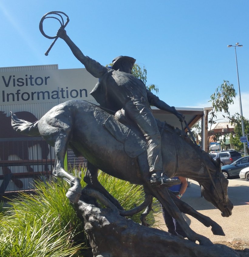
Jack Riley; The inspiration for A.B. “Banjo” Paterson’s poem “The Man from Snowy River” in Corryong, Victoria. We attended The Man From Snowy River Festival and watched a re-enactment of the horse chase and it was totally amazing!
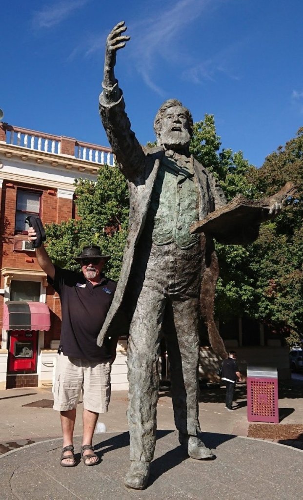
A larger than life statue of Henry Parkes in the main shopping area of Parkes, New South Wales. Henry is known as the Father of Federation. He was a great speaker and was known in particular for his Tenterfield Oration where he called for the federation of the six colonies of Australia.
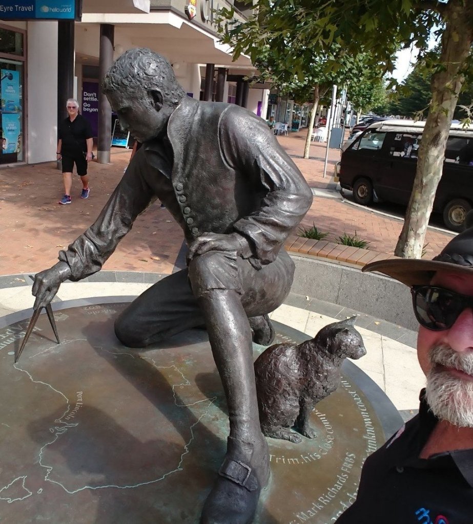
This sculpture in Port Lincoln, South Australia, commemorates navigator Matthew Flinders (1774 -1814) and his cat Trim. Trim was a ships’ cat who accompanied Matthew Flinders on his voyages to circumnavigate and map the coastline of Australia in 1801–03. The statue depicts Flinders kneeling and using his compass to chart his voyage along the South Australian coast. His map of Australia is on the base and he is measuring a part of the coastline.
“Pyramid” was created as a symbol of a perfect balance of community and friendship in the town of Forbes, New South Wales. It has however divided the community over it’s meaning. Tourists have been drawn to it and in it’s first year was the most photographed object in the town.
This is a life-size bronze statue of Captain Harry J. Butler AFC in Minlaton, South Australia. It depicts Harry in the role that he was most loved and known for, becoming the first man to fly across the Gulf St Vincent from Adelaide to Minlaton with the first bag of airmail to be carried across water in the southern hemisphere on August 6, 1919.
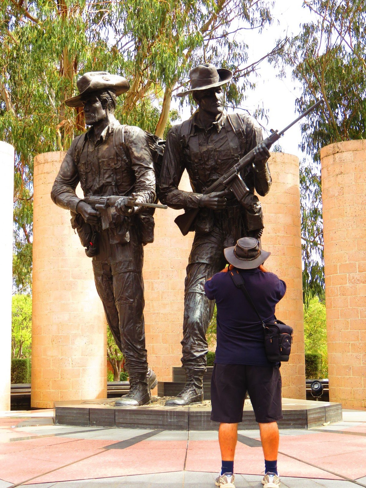
A memorial “to commemorate the courage and compassion” of John Simpson Kirkpatrick, a stretcher bearer during the Gallipoli Campaign in World War I. This full size bronze sculpture, Simpson and his donkey, 1915, stands outside the Australian War Memorial in Canberra.
This memorial is dedicated to the ‘diggers’ of the Australian Army who fought on the African Veldt, in the trenches of France, in the Western Desert and in the jungles of the Pacific and South East Asia. It is located on Anzac Parade, Canberra.
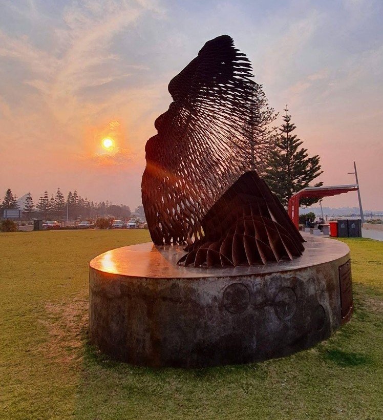
Wardandi Boodja is a five and a half metre steel bust which takes pride of place at the Koombana Foreshore in Bunbury, Western Australia. The sculpture represents the face of a Noongar elder, seeking to merge traditional sculpture and advanced fabrication technology to create a striking contemporary artwork that pays deep respect to the Noongar people. We took this photo at sunset.
These last two blog posts are but a minute representation of the thousands of incredible art works we have seen in the past six years. We hope you have enjoyed “seeing” them through our photography. Cheers to the next six years! 🙋♂️🙋♀️
The 12th of July 2022, is our six year anniversary of travelling Australia. We thought we would celebrate the milestone a little differently this year.
Instead of showing off the natural beauty of the landscapes, and the history of the areas, we will showcase the diversity of artworks that abound in the towns, cities and regional areas. There is so much to choose from, that we are going to do it in two posts. We hope you enjoy this artistic tour!
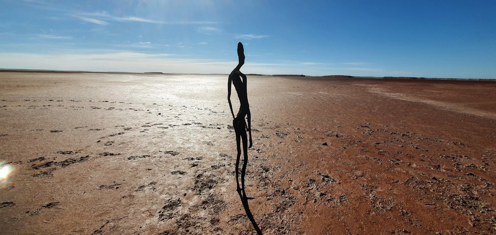
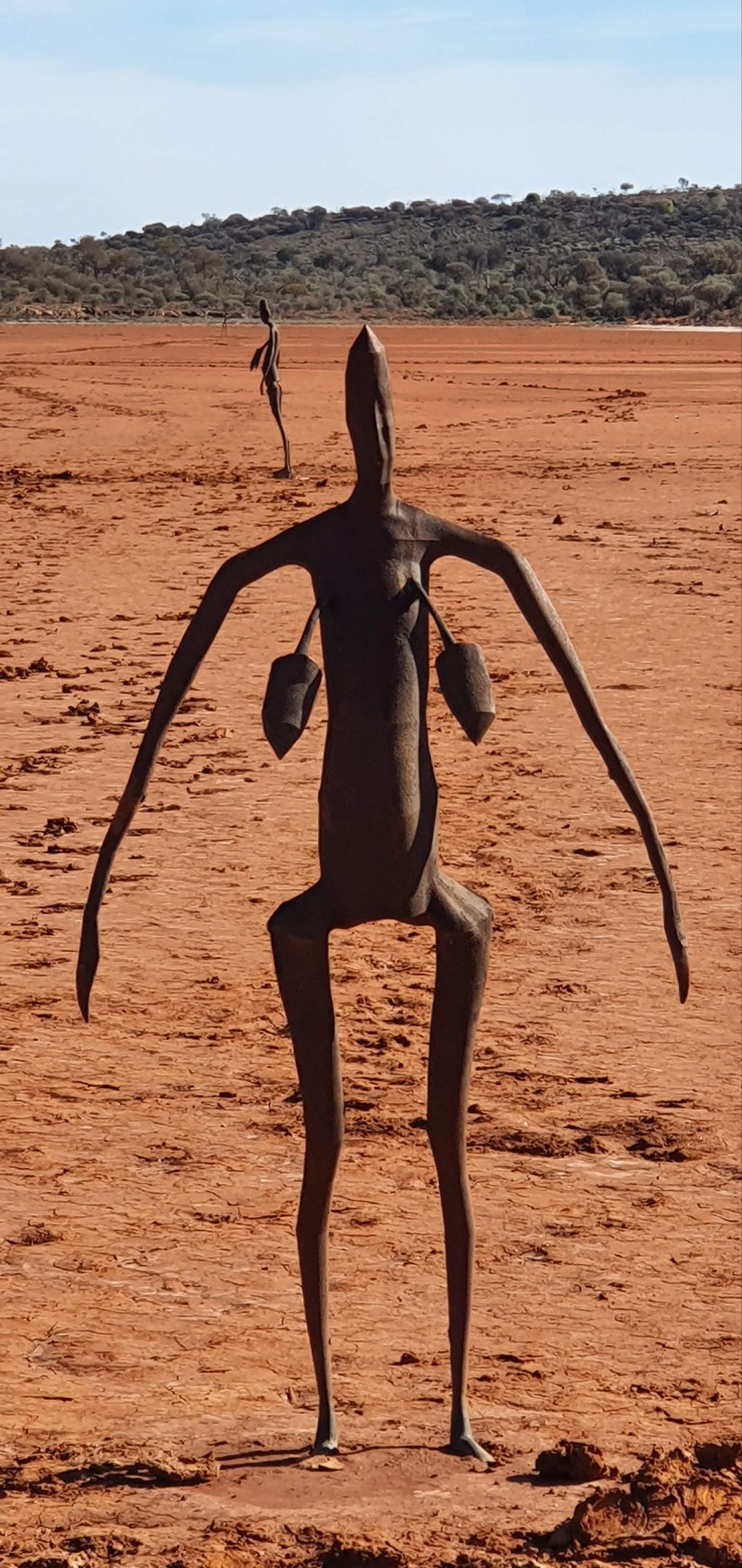
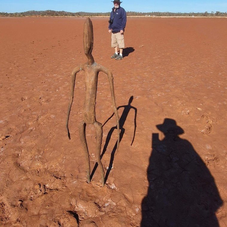
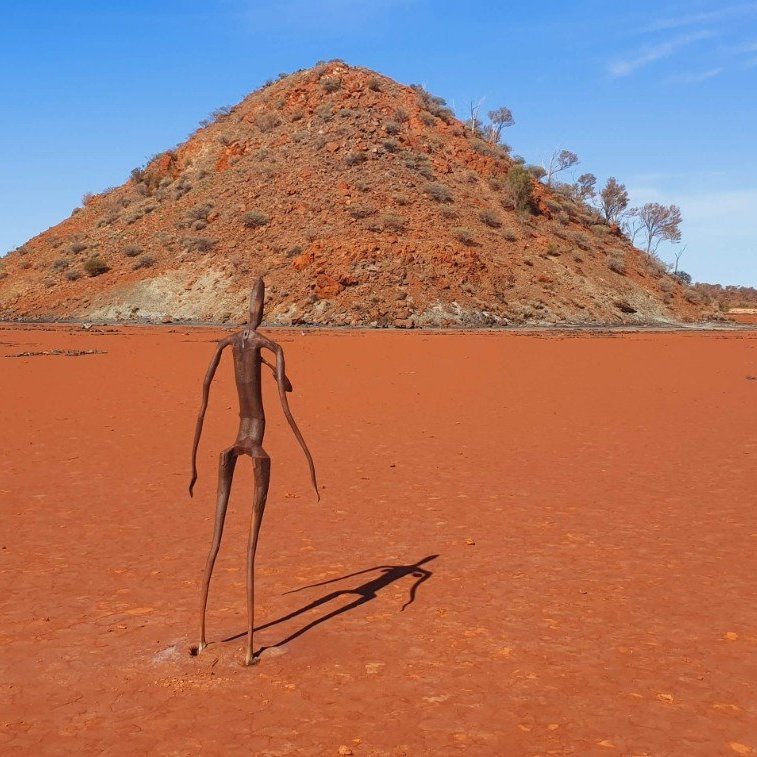
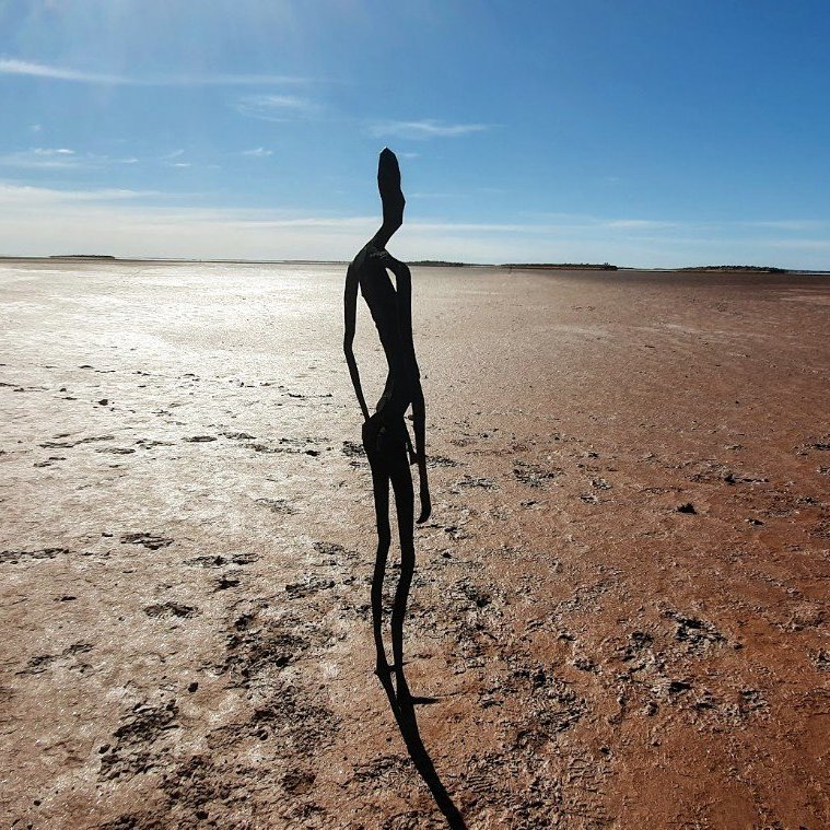
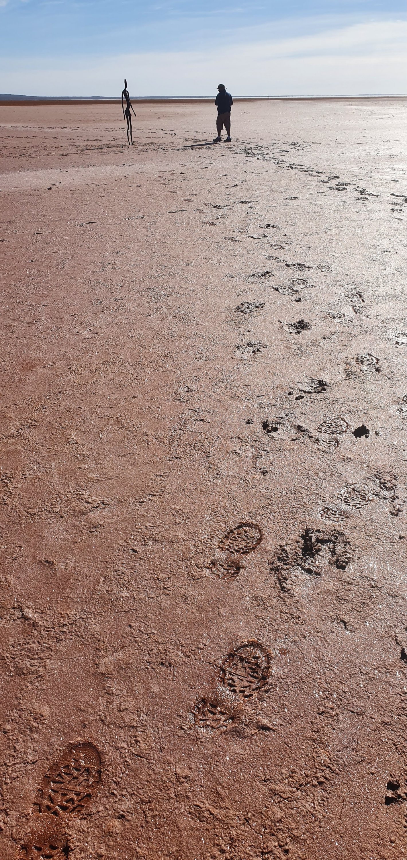
Lake Ballard, Western Australia
INSIDE AUSTRALIA, 2002 – 2003
“I wanted to try to find the human equivalent for this geological place. I think human memory is part of place, and place a dimension of memory.” Sir Antony Gormley OBE RA. The artwork is a collection of 51 black steel sculptures standing over 10 square kilometres of the white salt plain of Lake Ballard. Each sculpture represents one of the 131 local residents, whose bodies were scanned for casts. The work was developed as part of celebrations for the 50th anniversary of the Perth International Arts Festival.
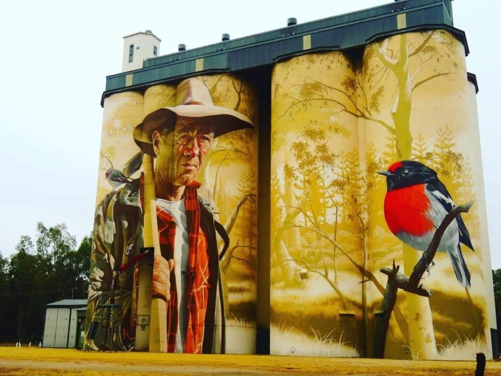
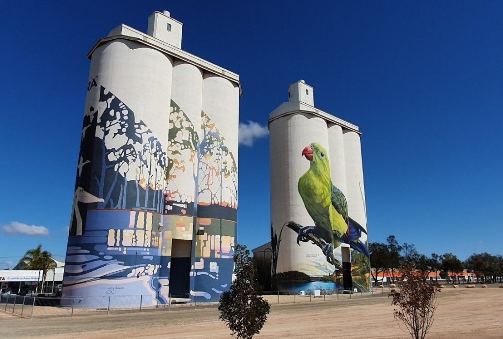
Silo / Water Tower / Street Art
Wirrabara, SA, silos were painted in late 2018 by Australian realist artist, Smug (Sam Bates). The mural depicts the town’s strong ties to the forestry industry as well as the local flora and fauna.
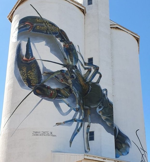
Waikerie, SA. Local artist, Garry Duncan and Melbourne artist, Jimmy DVate depicted their interpretation of the theme, Healthy River Healthy Community.
Waikerie
Kimba, SA. Australian mural artist Cam Scale transformed the silos with a mural of a child and sunset landscape.
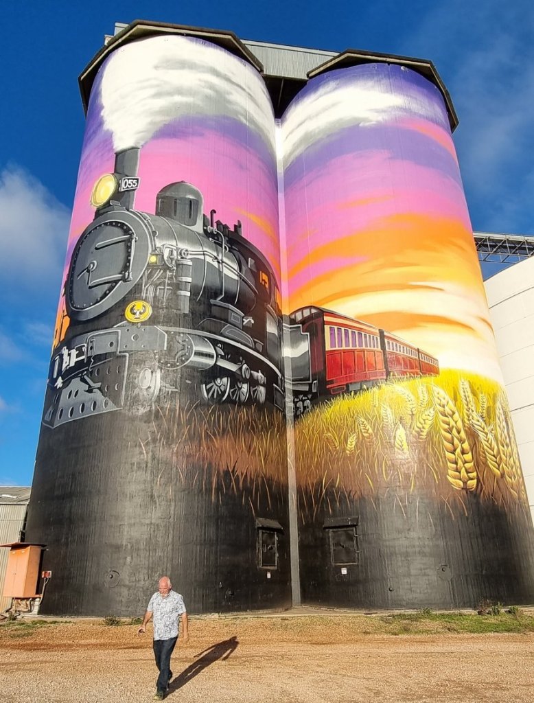
Farrell Flat is the latest installation to join the South Australian silo art trail. It depicts the last train to pass through this historic township.
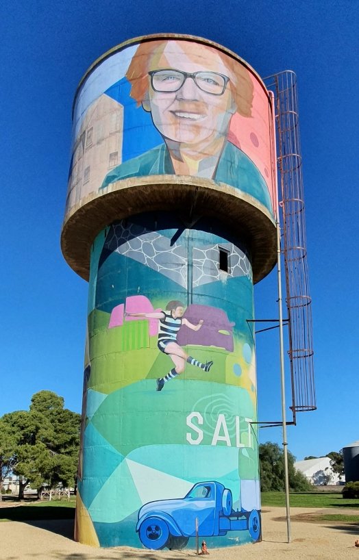
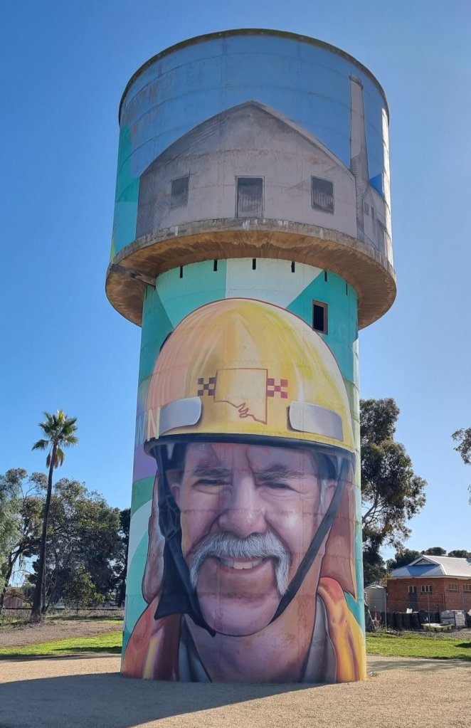
The Snowtown, SA, disused water tower near the town’s centre now depicts the bright faces of local volunteers and sports stars, including the games record holder of Blyth Snowtown Football Club, Simon McCormack.
One of the volunteers is local Country Fire Service volunteer of more than 25 years John Hansen. He features prominently on the tower and is the image that faces the road. The other face is Snowtown ambulance volunteer Jenny Cox.
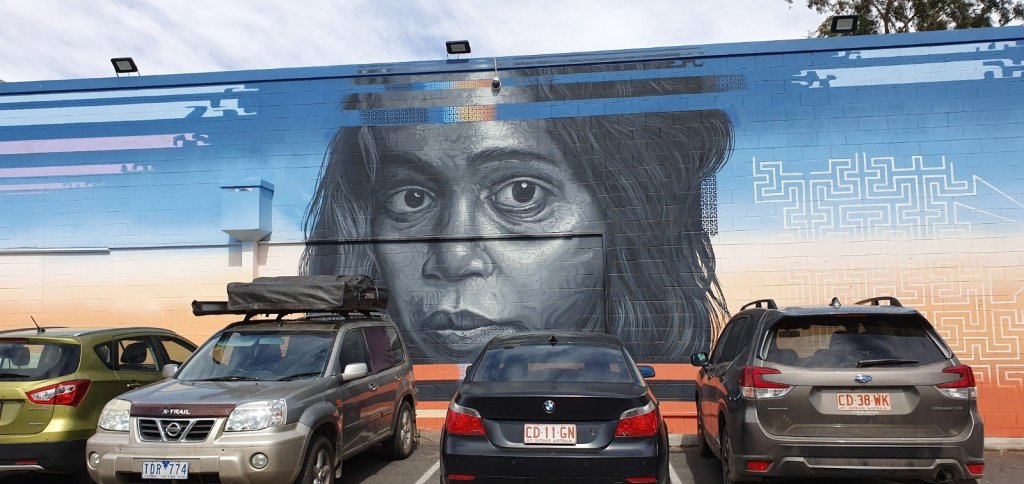
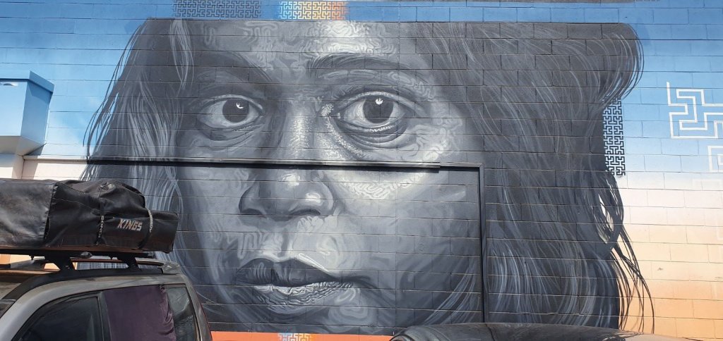
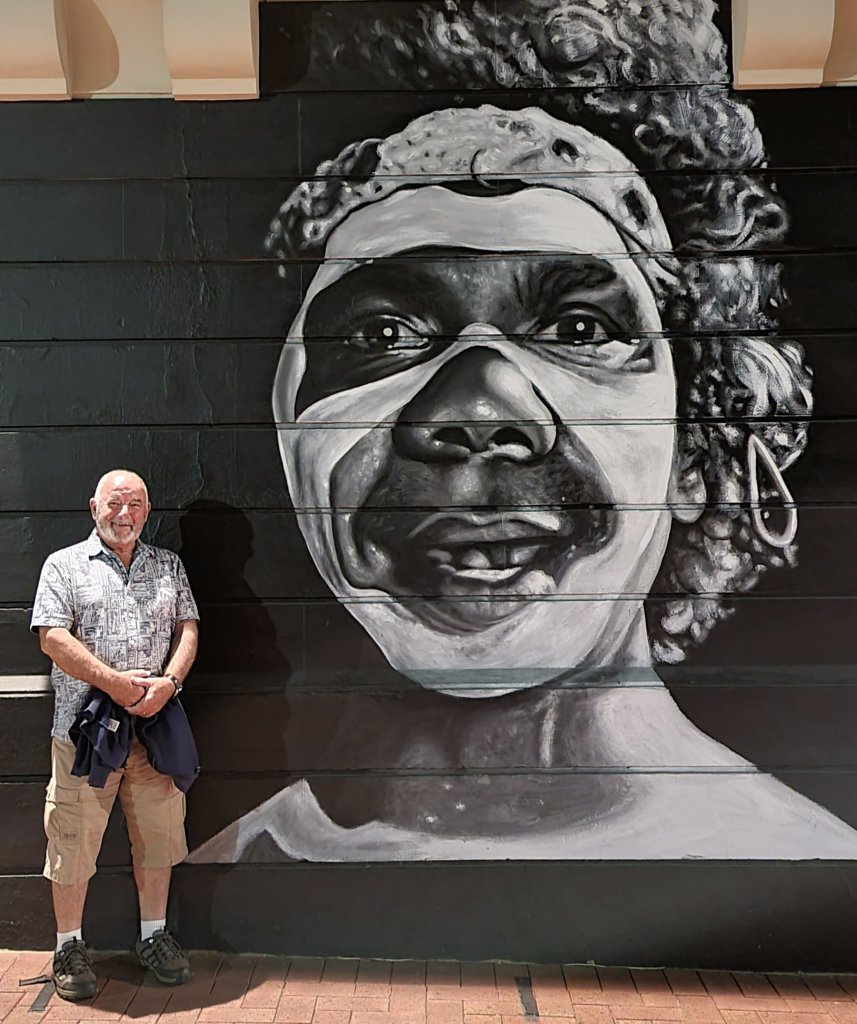
Samson and Delilah & Sweet Country
These stunning portraits of indigenous actors Rowan McNamara and Marissa Gibson were painted by Lee (Linz) Harnden and Peter (CTO) Seaton. They can be found on the Alice Springs Cinema Complex wall.
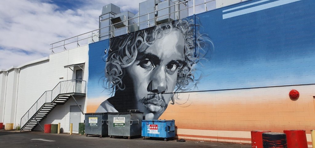
The David Gulpilil mural is located on the side of Tandanya National Aboriginal Cultural Institute in Adelaide’s East End and celebrates the life and work of the Yolŋu actor, dancer, singer and painter.
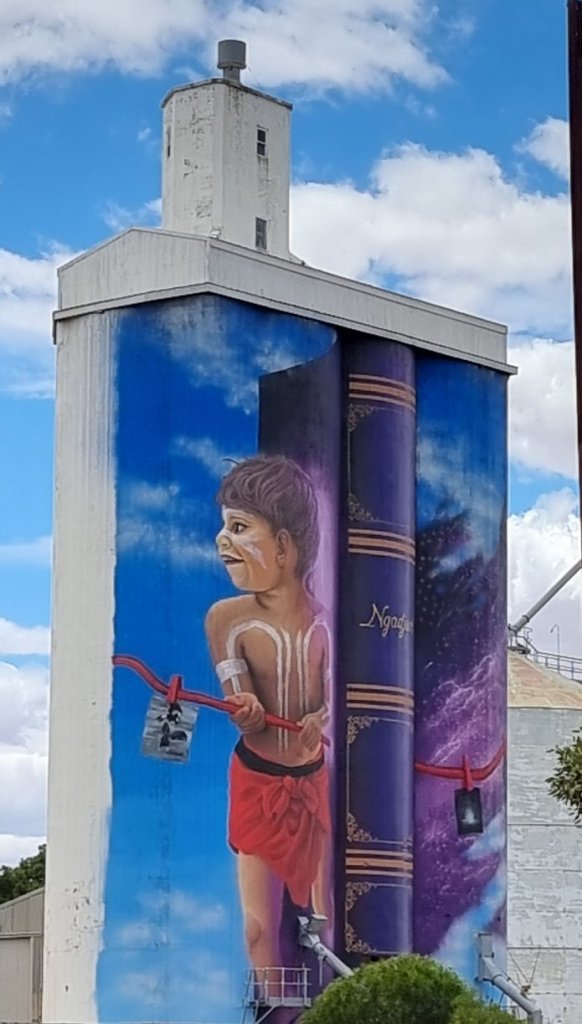
Eudunda: The Storytime Silos’, is based on a story written by local author, Colin Thiele ‘The Sun on the Stubble’. The book tells a story about two children sharing stories about their past and culture that invokes playfulness, open-mindedness and joy that we see in children.
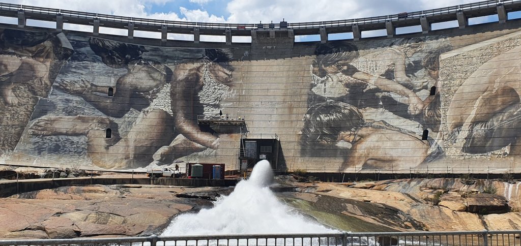
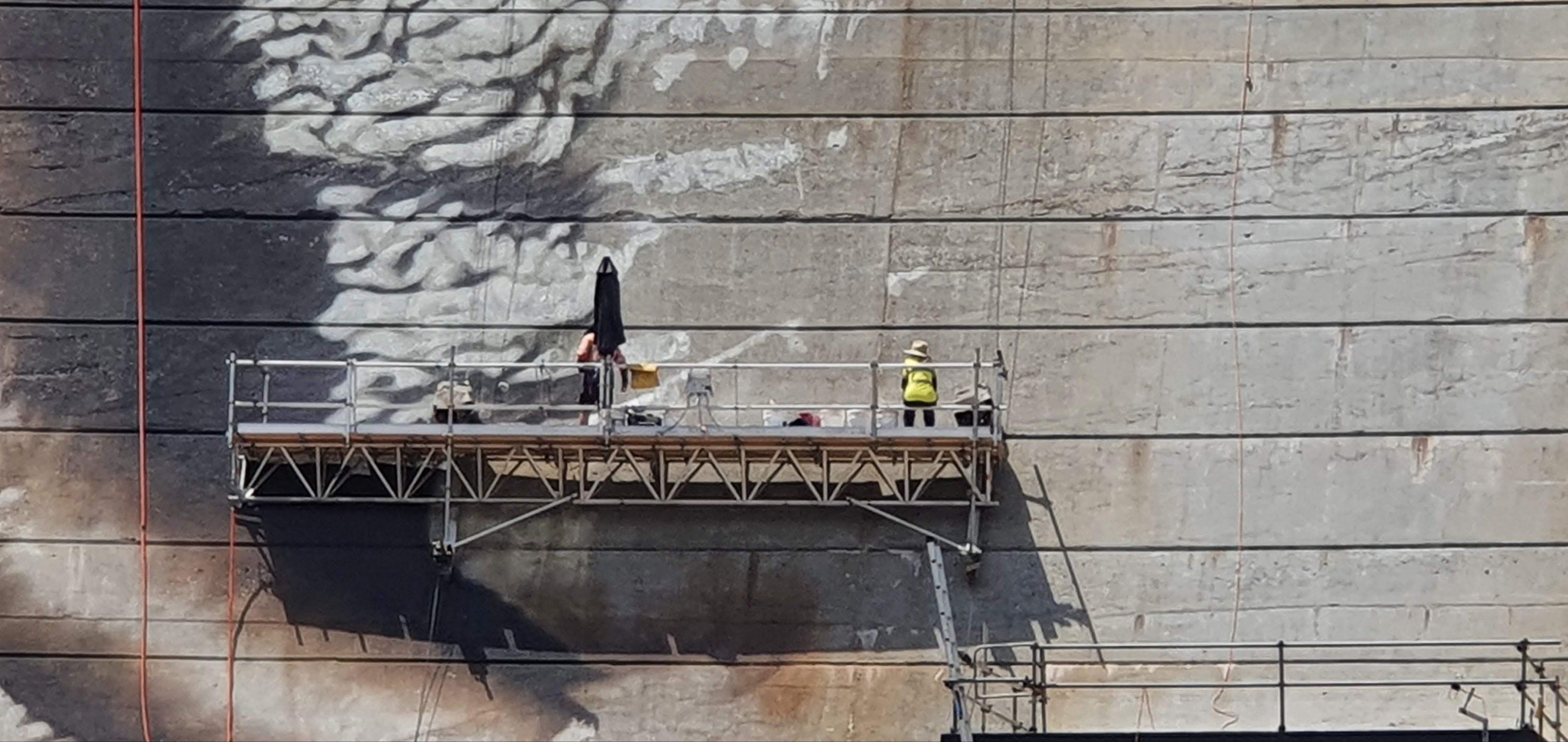
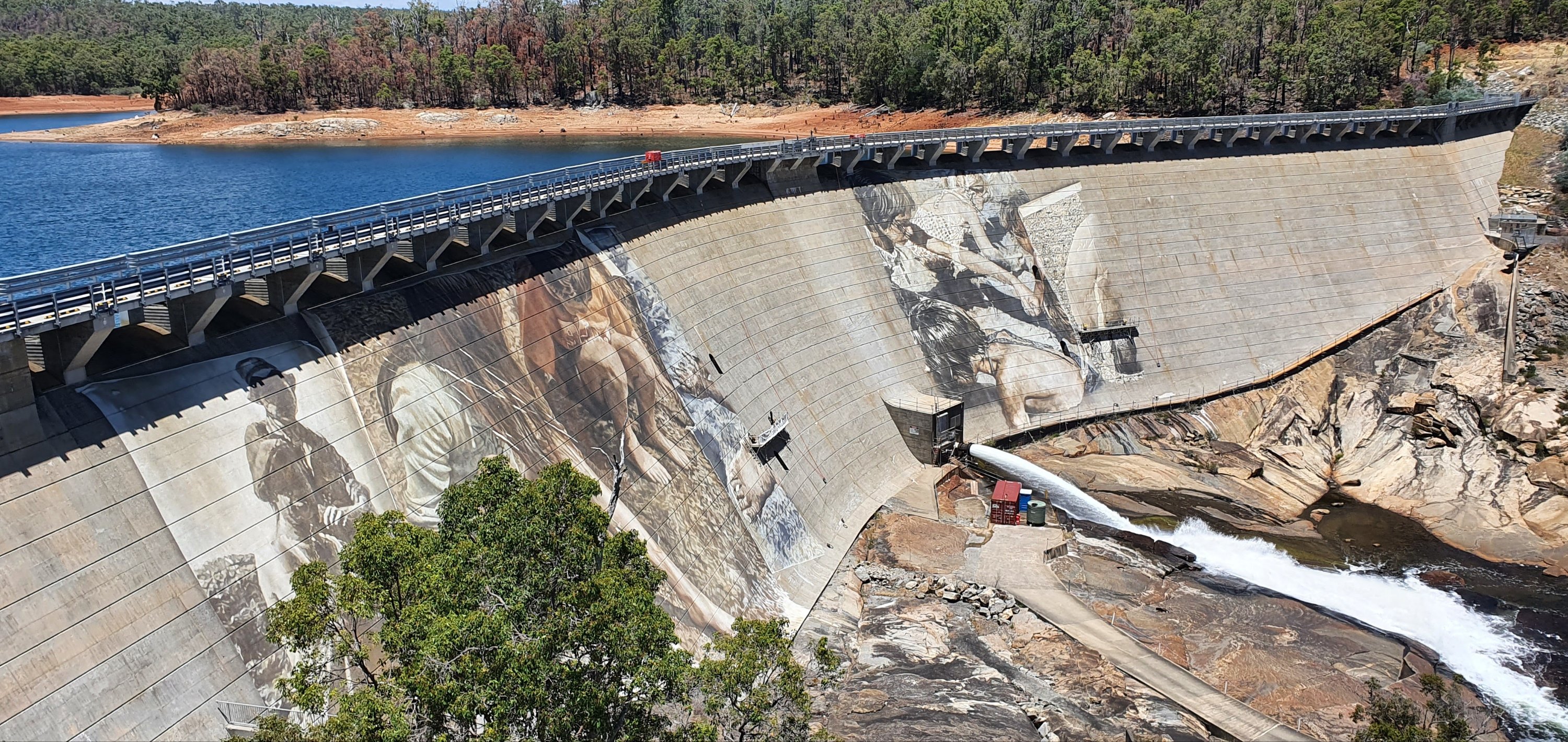
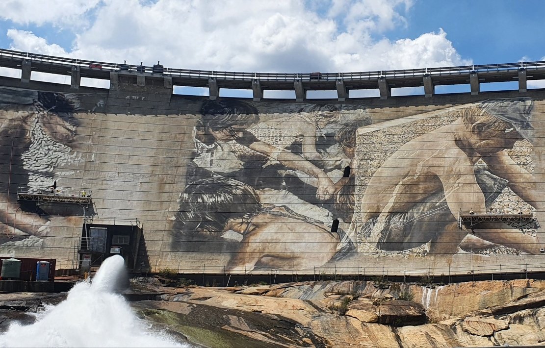
Guido Van Helton has painted across a vast surface of the Wellington Dam in Collie, Western Australia, making it the biggest dam mural in the world!
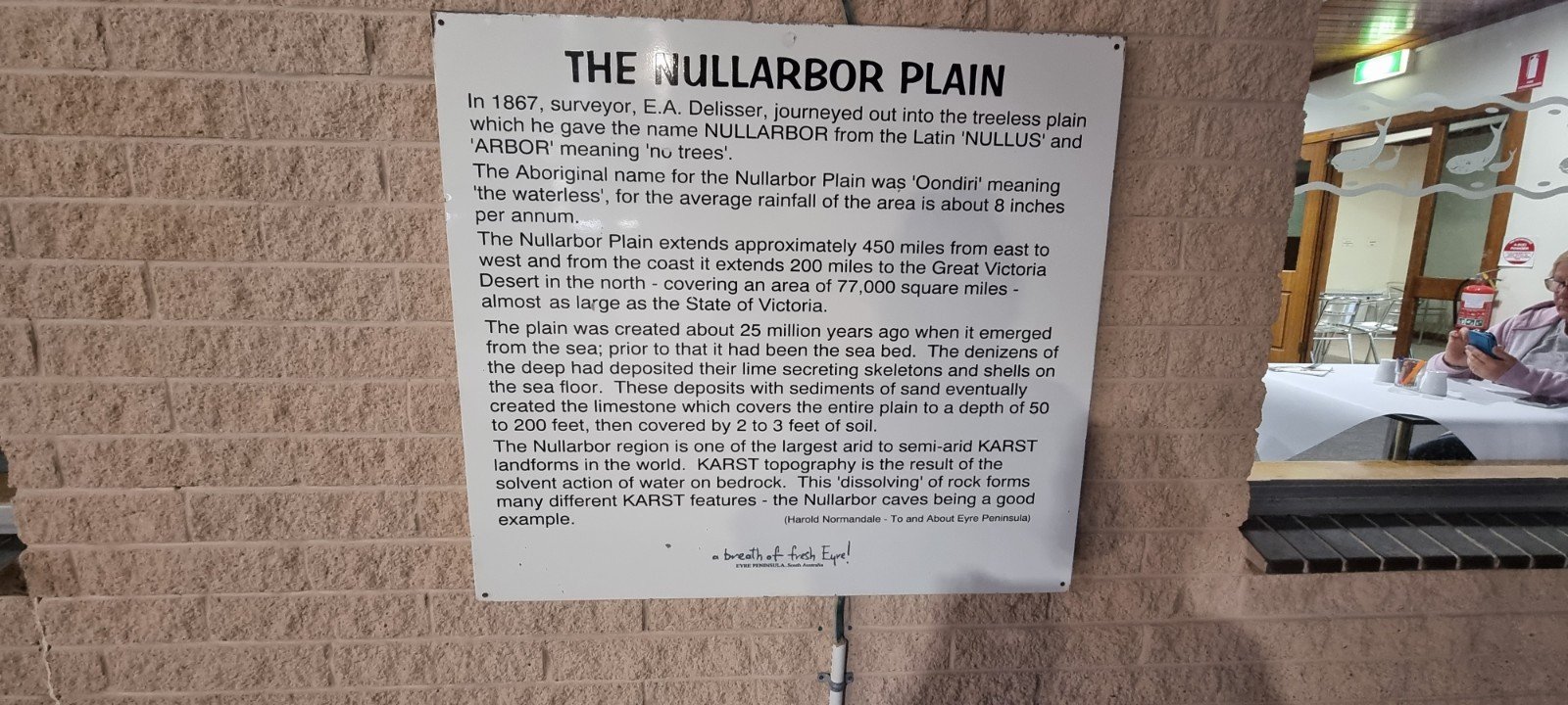
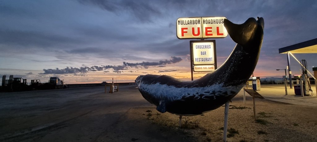
The Nullarbor Nymph was a hoax perpetrated in Australia between 1971 and 1972 that involved supposed sightings of a half-naked woman living amongst kangaroos on the Nullarbor Plain.
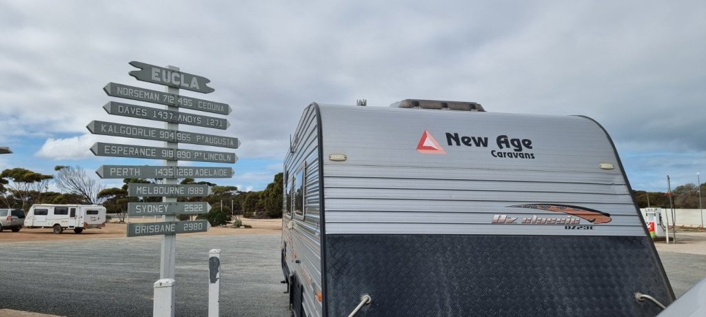
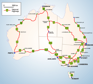
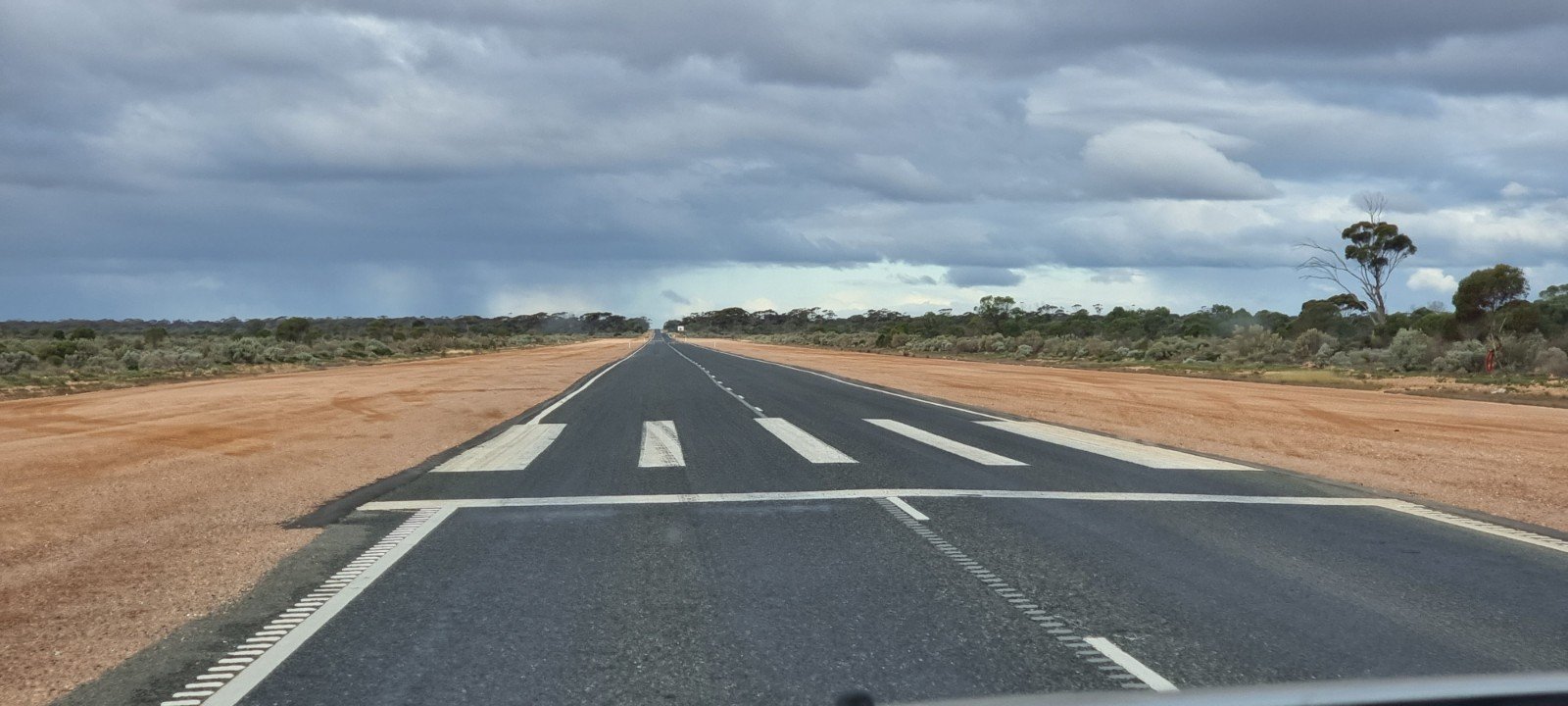
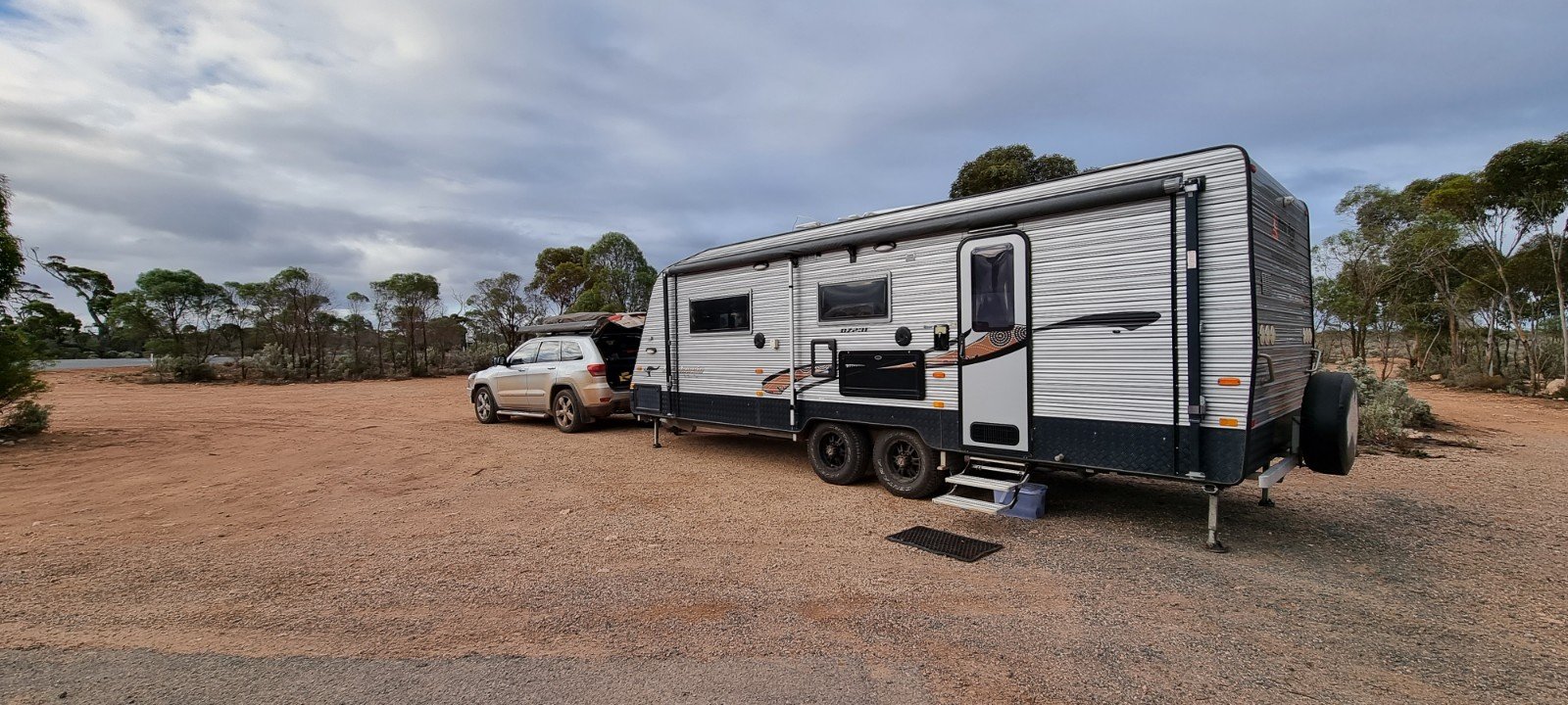
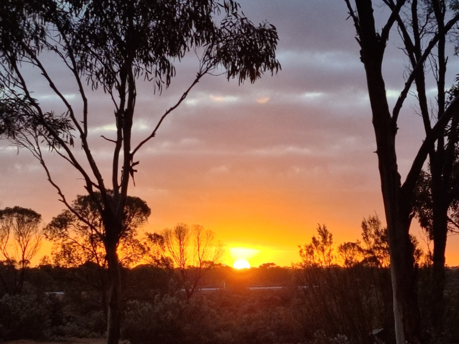
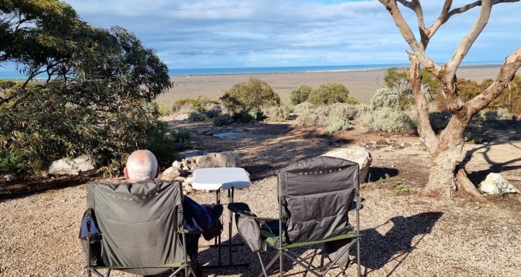
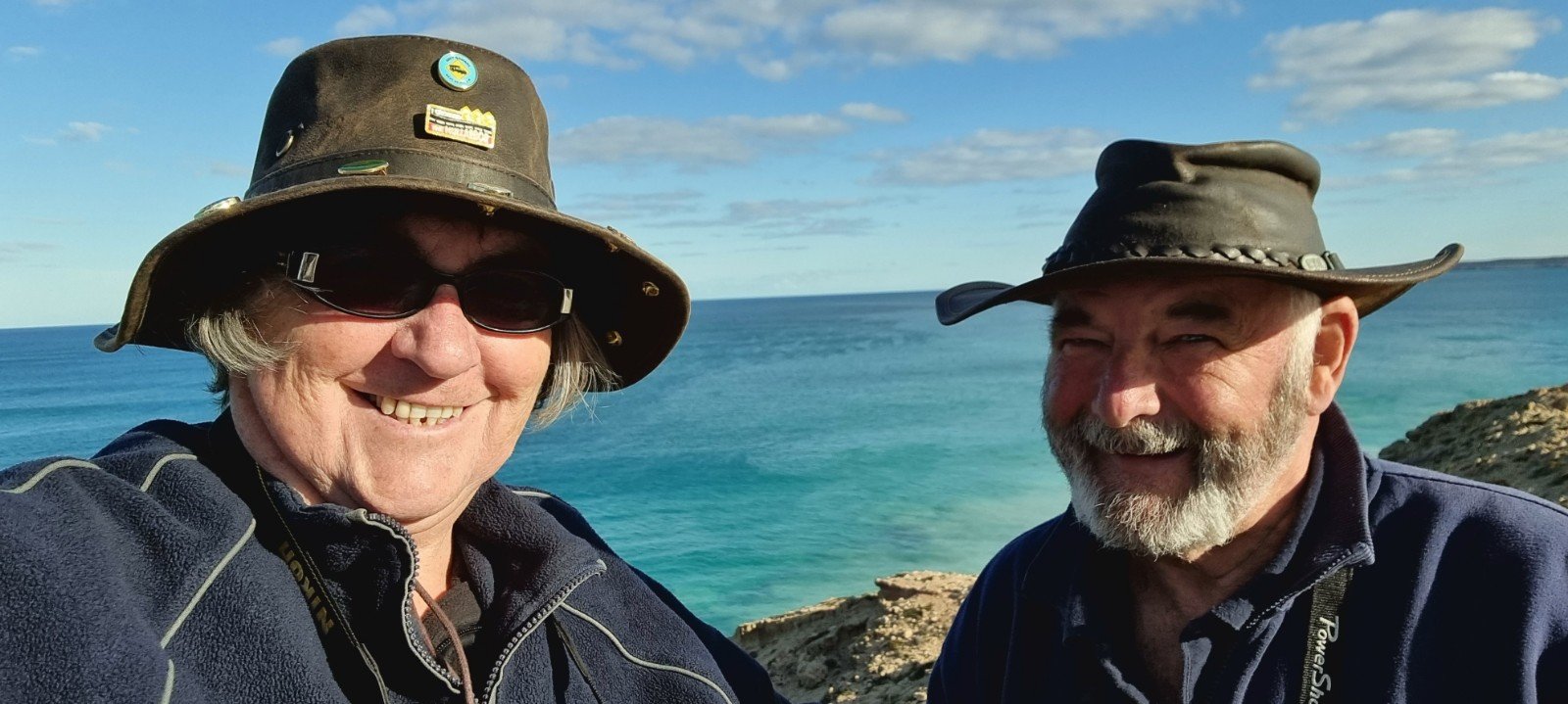
June 2021 we left Kalgoorlie and made our way to Norseman. This is the 7th time we have driven across and the 4th time West to East. After a couple of overnight stops at free camps, we stopped at Eucla,13km from the WA/SA border. We have travelled 708km across the Eyre Highway (Nullarbor) from Norseman. There is another 489km until we reach Ceduna, considered to be the end of “crossing the Nullarbor.” We are taking our time and only doing a few hundred km each day. In comparison to previous times, there is actually minimal traffic on the roads, with more heading West than East. The roadhouses and free camps have had plenty of sites available, with lots of space to spread out. We are spending a few days at Eucla to soak up the views and the sunny weather. Then we will cross into SA and onto the Nullarbor Roadhouse where we will base ourselves for 4 days to watch the whales at The Head of Bight. 🙋♂️🙋♀️🐳🐳
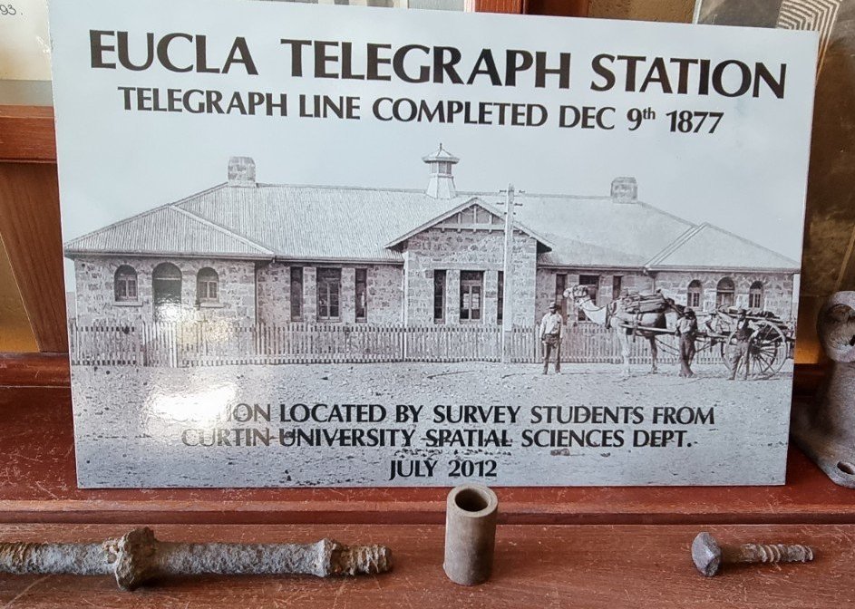
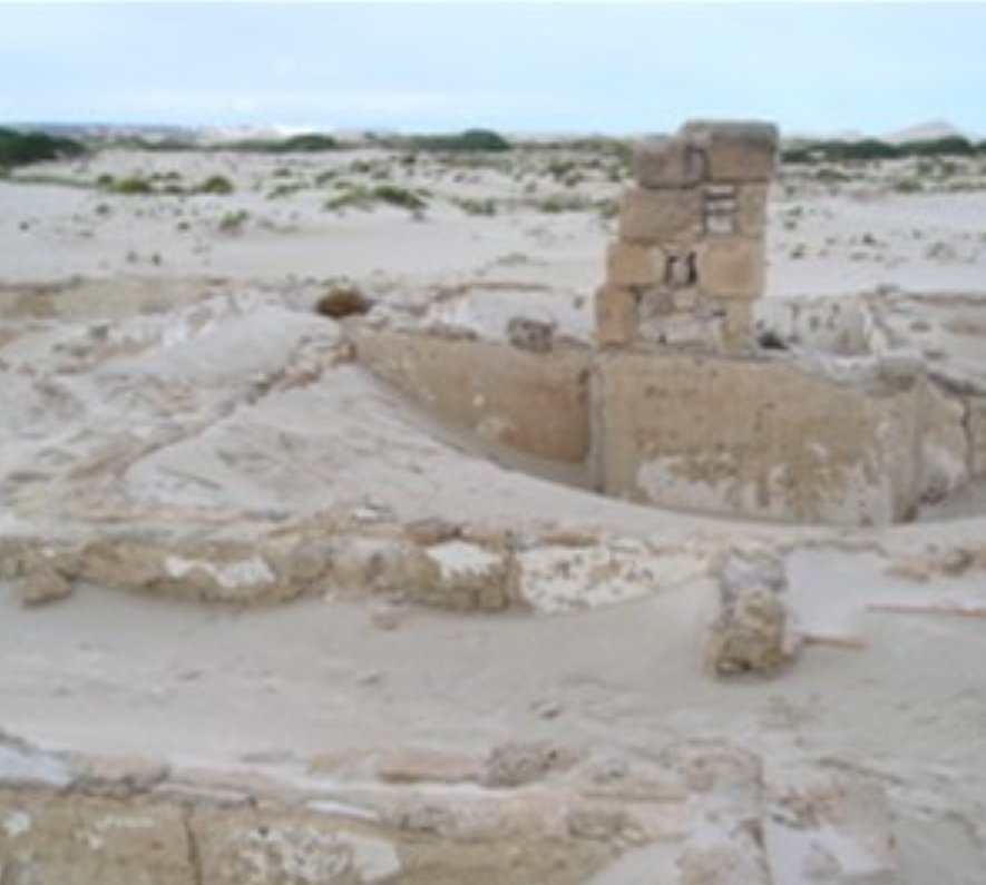
In the early 1900s Eucla was the country’s busiest telegraph station outside Australia’s capital cities. The old Telegraph Station at Eucla is one of the iconic and lonely images of the Nullarbor. It is now nothing more than a few old stone walls slowly disappearing under huge white sand dunes on the edge of the Great Australian Bight.
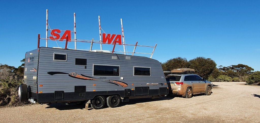
The iconic SA/WA border sign. The first time in seven crossings that we actually worked out how to get to it!
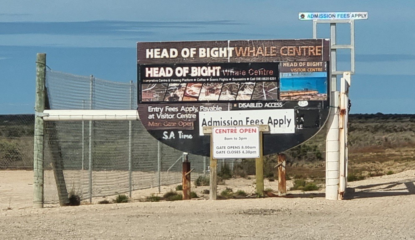
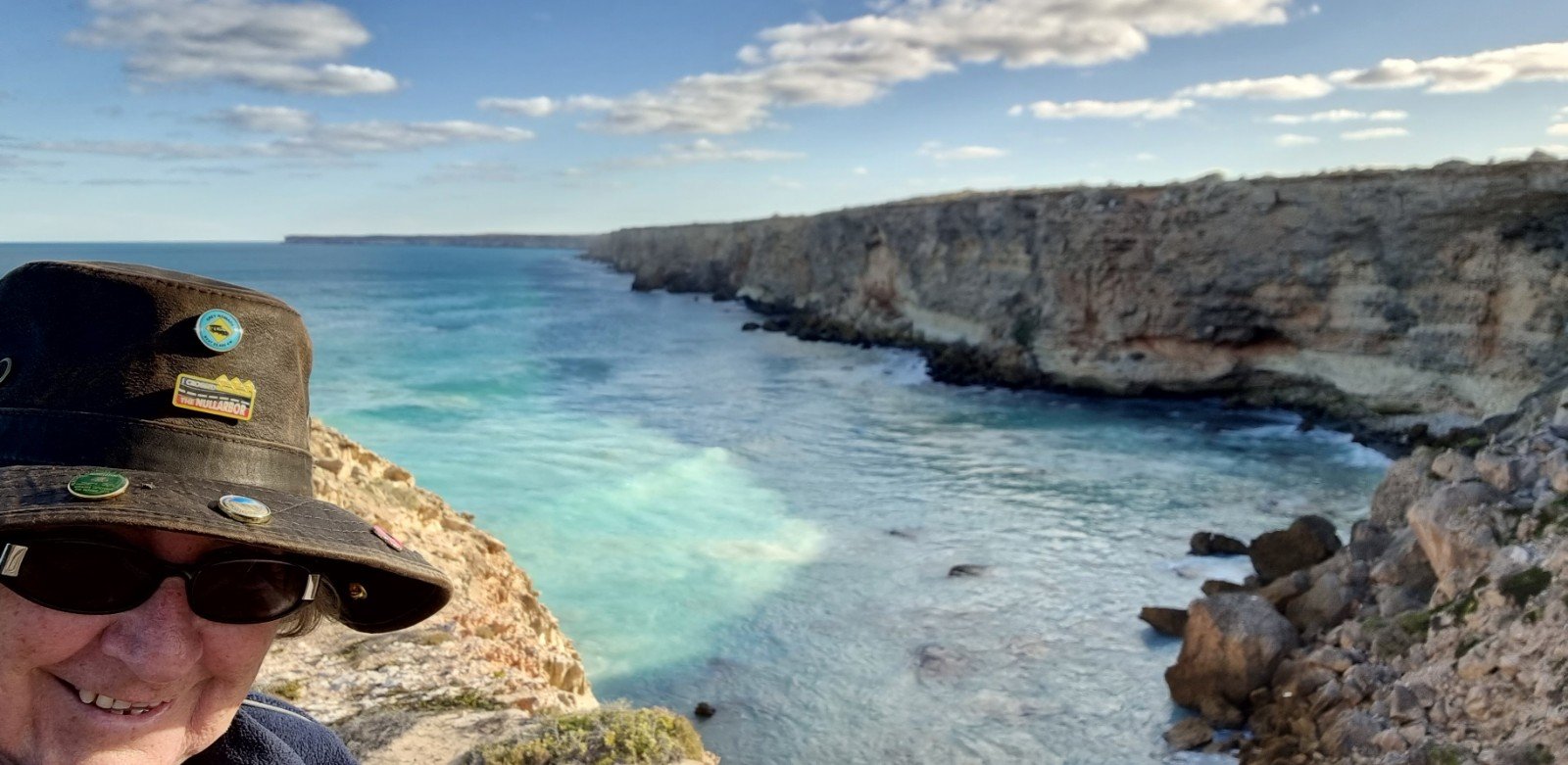
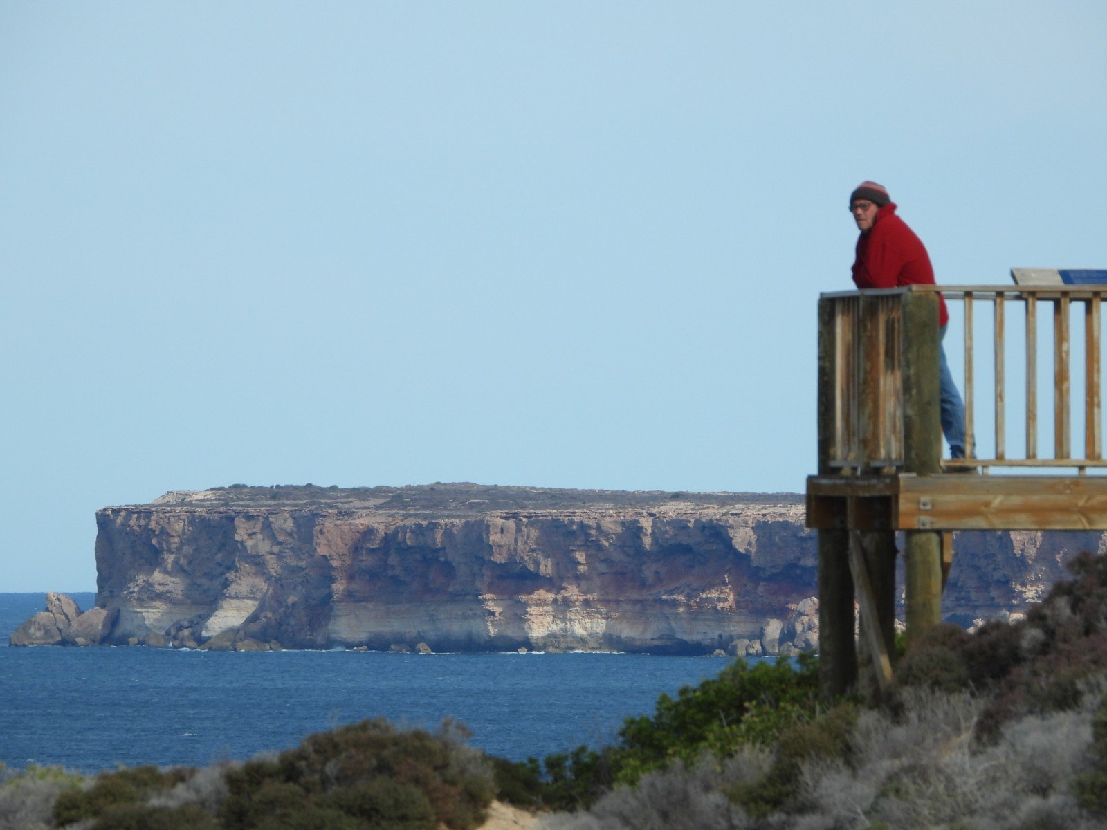
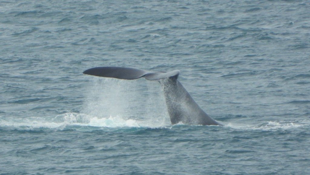
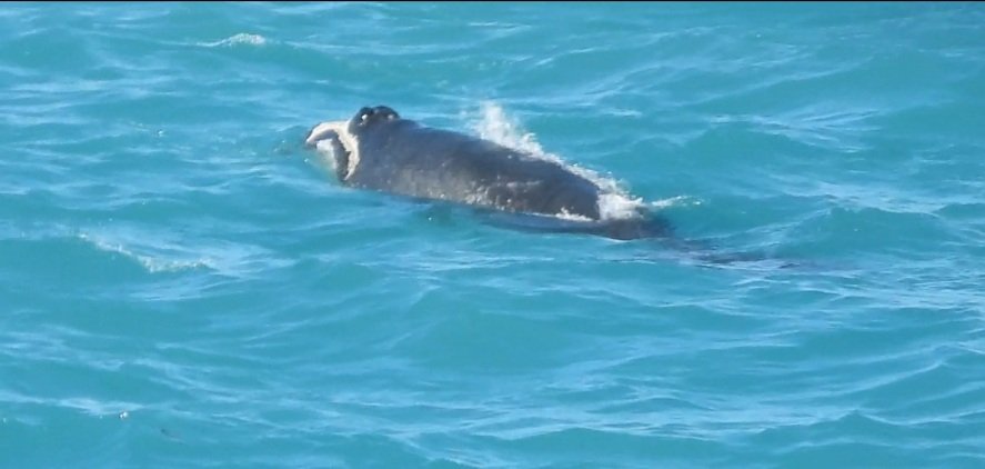
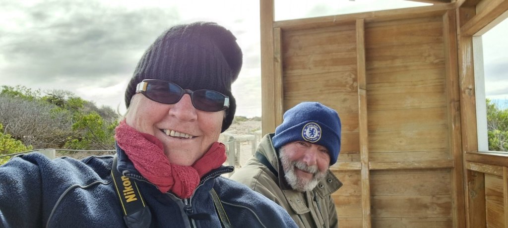
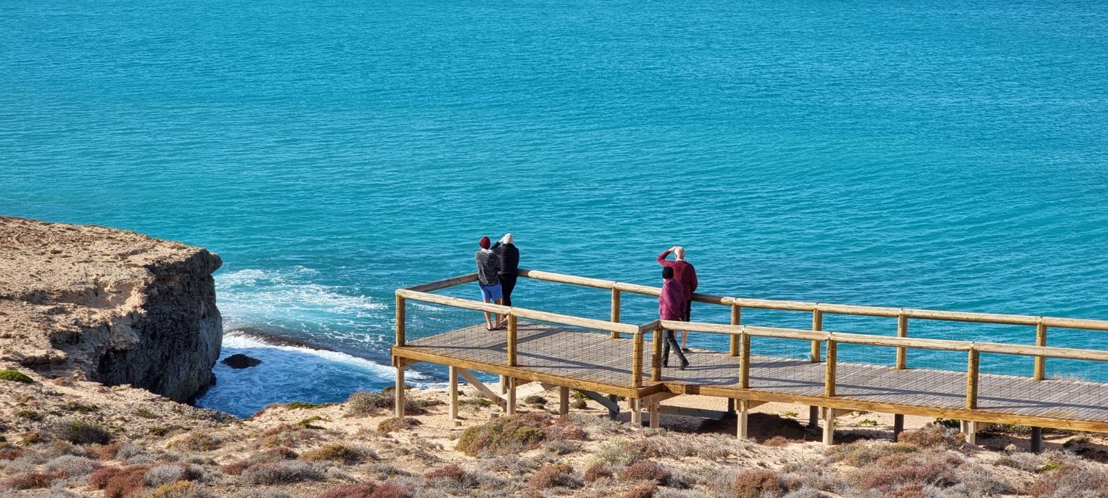
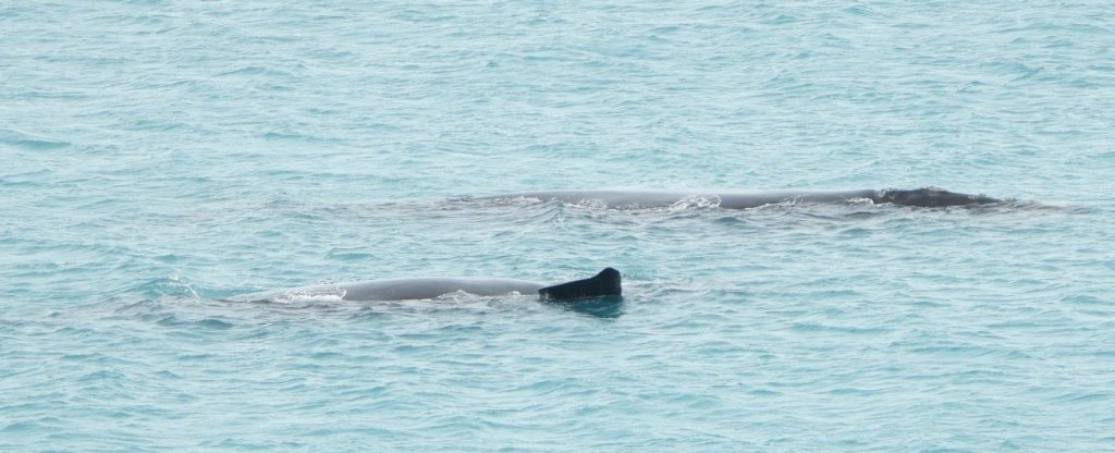
Our crossing into South Australia was a bit of an anticlimax. We had received our Covid permits to enter SA and had printed them out, all ready to show them to the border officers……..but nobody to be seen anywhere at all. So we just carried on towards the Nullarbor Roadhouse 184 kilometres away and where we would be staying four nights. (Update – a few days later it would have been a very different story. A Covid outbreak had Police manning the border checkpoints and they weren’t allowing a lot of people to cross.) We had a fantastic four days at the Head of Bight Whale Watching Centre which is only a short drive from the roadhouse. It is one of the most significant places for a unique opportunity to view the large numbers of Southern Right whales to congregate “en masse” and give birth in a semi-protected environment. There are a number of viewing platforms which also show off the spectacular backdrop of the Bunda Cliffs. Below are just a few pics of these majestic Southern Right Whales, some with calves. Lots of cruising, blowing, tail slapping and the odd breaching. Can’t wait to go again! 🐳🐳
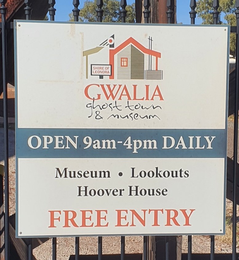
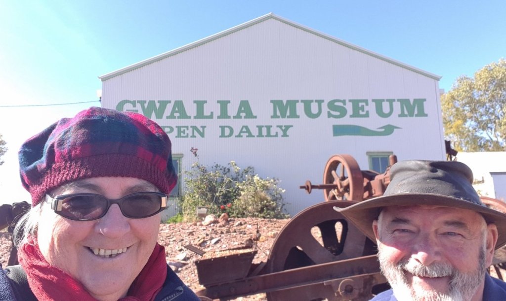
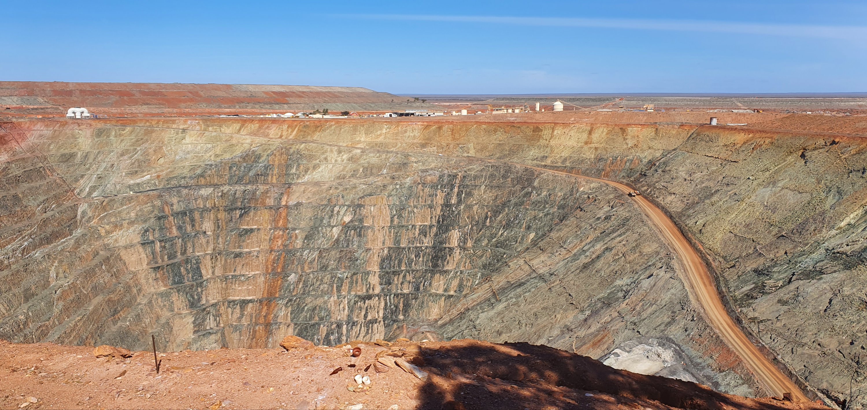
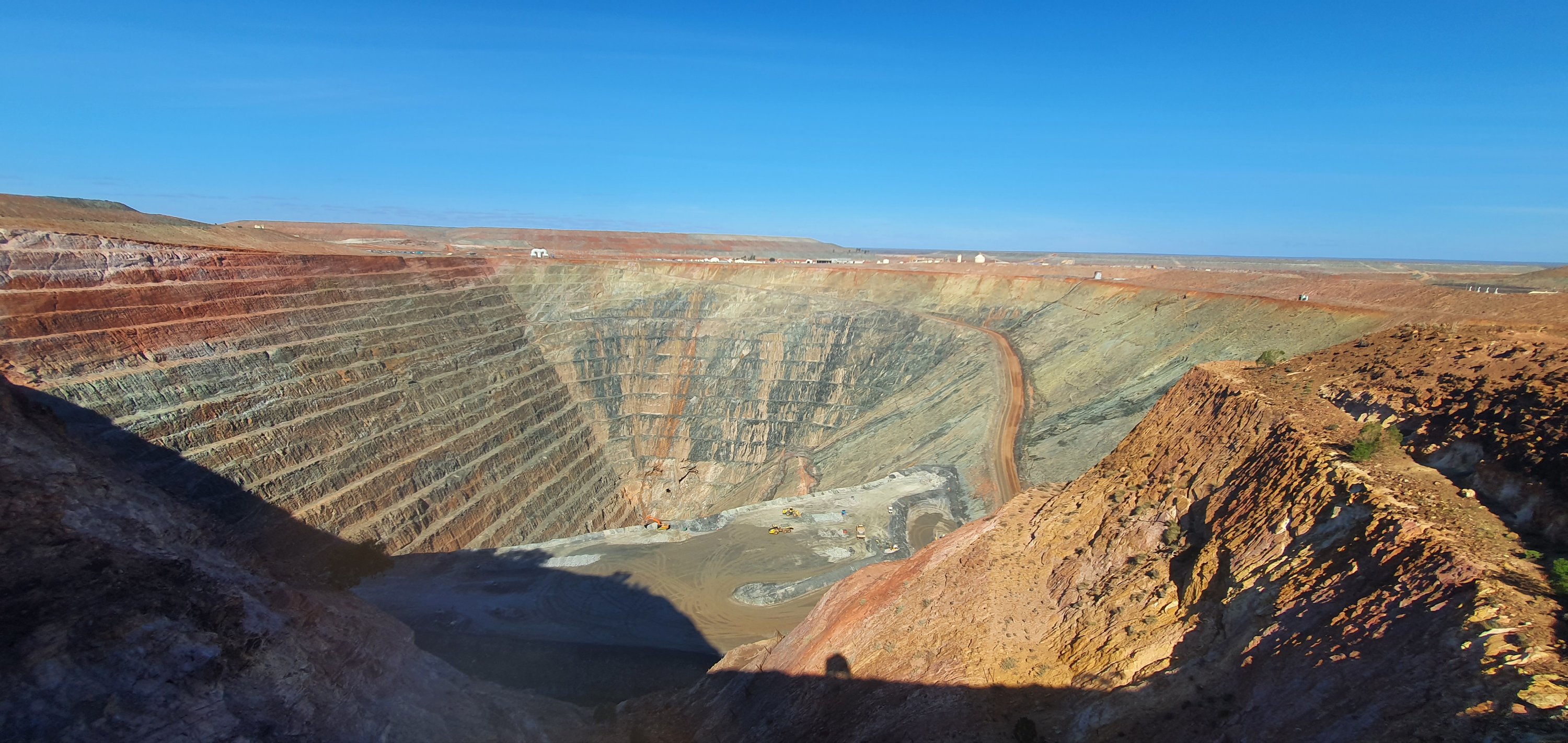
Just over an hour north of Menzies is Gwalia which is essentially a ghost town. The Sons of Gwalia gold mine, closed in 1963. Just four kilometres north is the town of Leonora, which remains the centre for the area’s mining and pastoral industries.
Underground mining at the Sons of Gwalia began in 1897, and continued until 1963. During this time it produced 2.644 million ounces (82.24 tonnes) of gold down to a depth of 1,080 metres (3,543ft) via an incline shaft. Sons of Gwalia grew to become the largest Western Australian gold mine outside Kalgoorlie, and the deepest of its kind in Australia. The 2.644 million ounces recovered (1897–1963) amounts in value to US$4.34 billion (A$4.55 billion) at August 2012 prices.
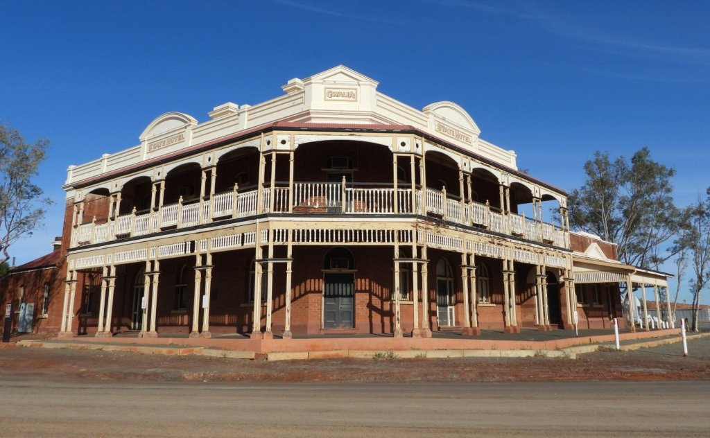
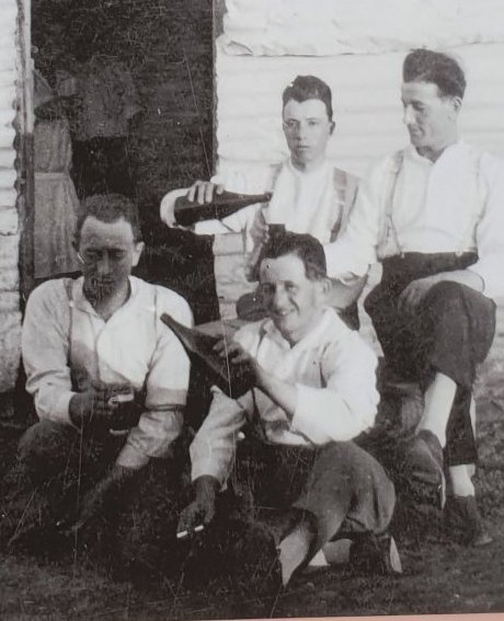
Shaped from repurposed old timber and corrugated iron sheets, the town of Gwalia sprang up from the red dirt surrounding the goldmine like wildflowers after the rain. Home to 1200 people – including future-US president Herbert Hoover – its patchwork streets were soon filled with shops, houses, a school, church and a community centre, along with the impressive Gwalia State Hotel, a stylish brick building that was the place to be seen on an evening or a weekend.
From the website it is written – “On the 6th December 1963 the Directors’ met to discuss the mine’s losses and discouraging geological reports. The decision is made to close the mine on 31st December, however the Mine closes three days early. Extra trains were arranged to manage the exodus of people leaving their homes and belongings. Gwalia’s population dropped from 1,200 to 40 in less than three weeks.”
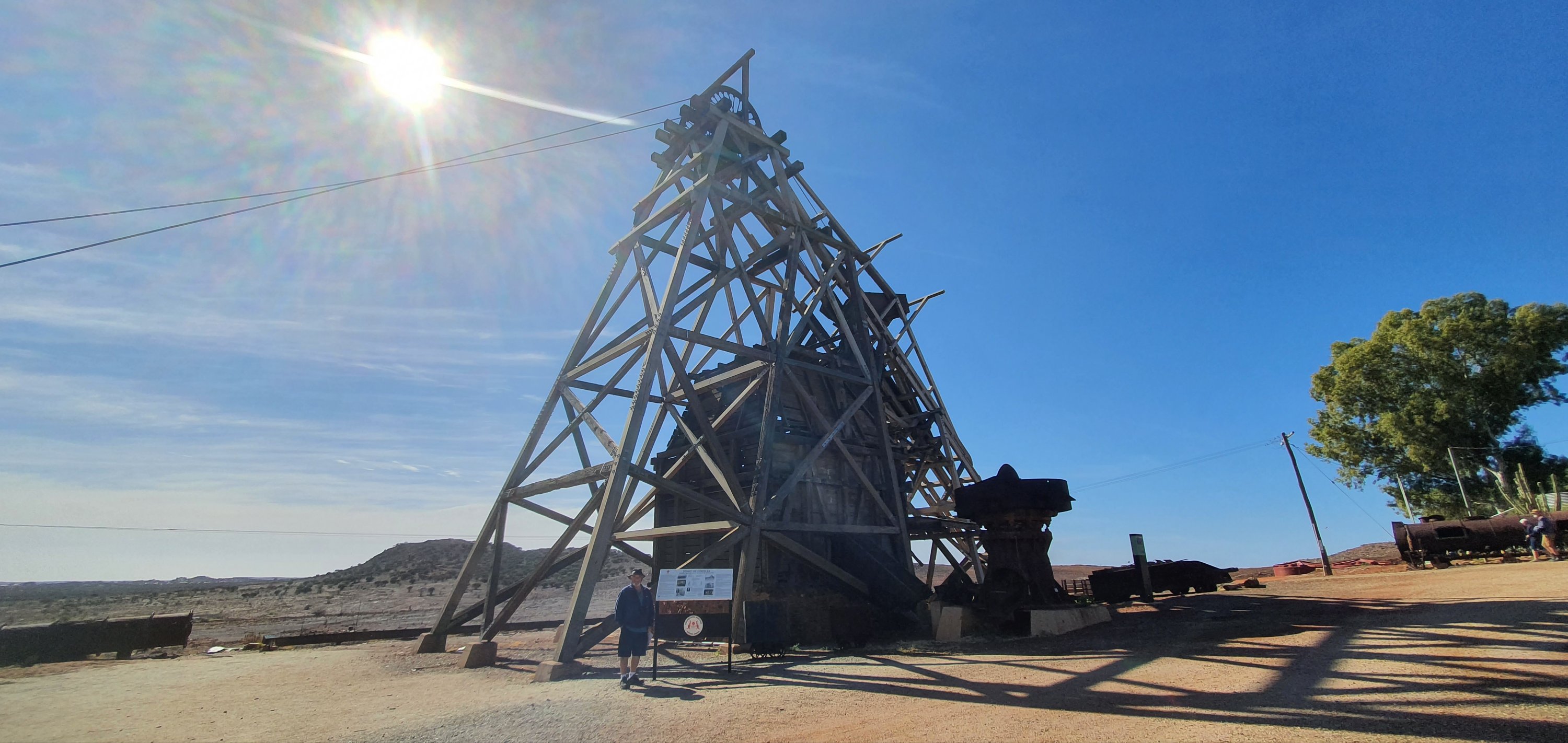
A historical preservation effort began in 1971 to restore and preserve the town’s remaining homes and buildings, as well as the mine’s original structures (headframe and winder building).
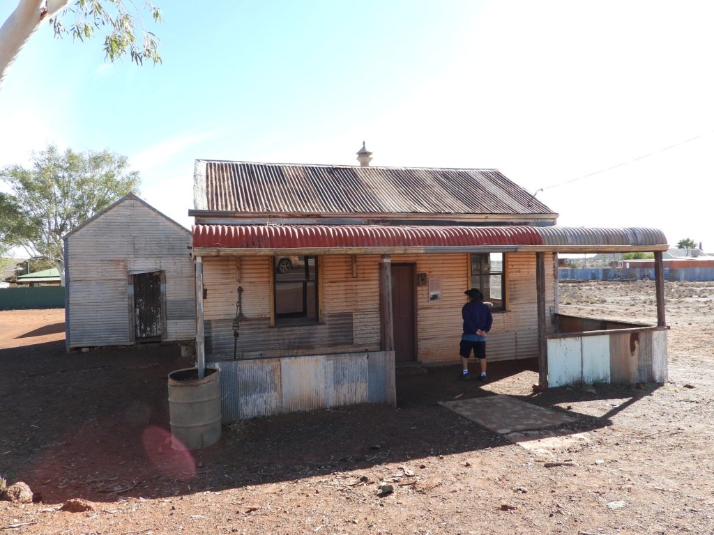
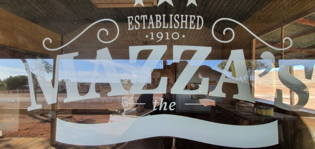
As written on the website of gwalia.org.au, “The Gwalia experience is three-dimensional: step inside the quaint cottages built of corrugated iron, timber and whitewashed hessian and imagine a miner’s wife cooking dinner on the cast iron range, while her husband toils far underground to support his family and their children recite their lessons in the State school. Look through the windows of Mazza’s Store, where the shopper could buy everything from two pounds of flour for the day’s baking to a length of fabric to make a frock for a dance at the State Hotel – or wander through Patroni’s Guest Home next door, for decades a home from home for single men employed at the Sons of Gwalia Mine.”
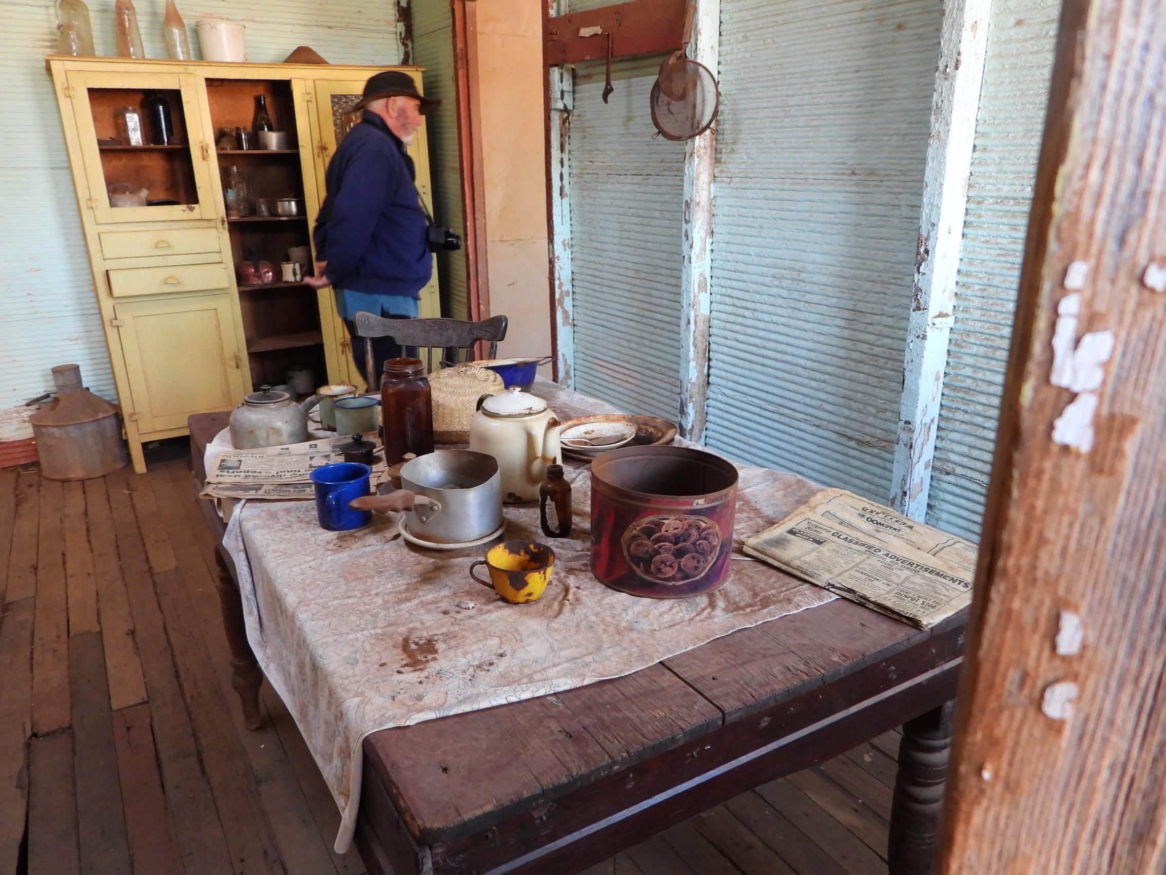
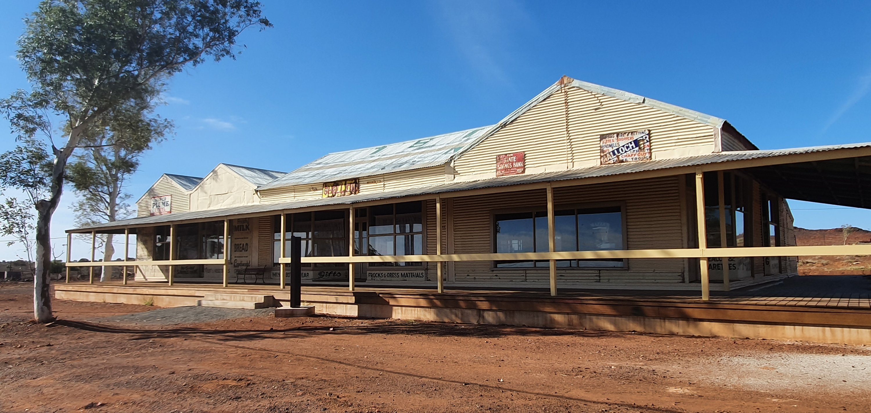
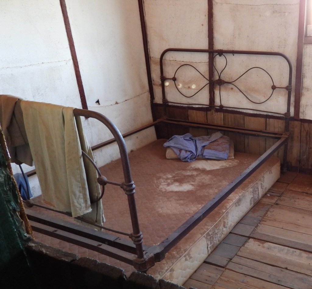
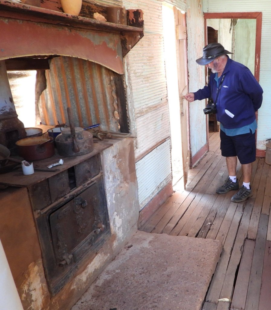
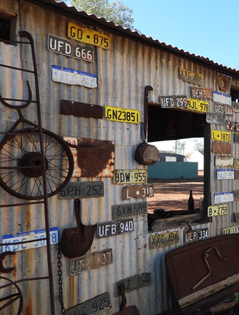
We parked our car in front of old Mazza’s Store and spent the next few hours exploring the ins and outs of all the buildings.
The buildings have been faithfully restored and have a number of information boards explaining their usage and history. As you enter each one, you literally feel a ghostly presence of those who lived and worked there. In one house there is an upright piano and as you look at it, you think you can see the keys actually move, and hear the melancholy sounds of an old hymn being played. It makes the hairs on the back of your neck stand up.
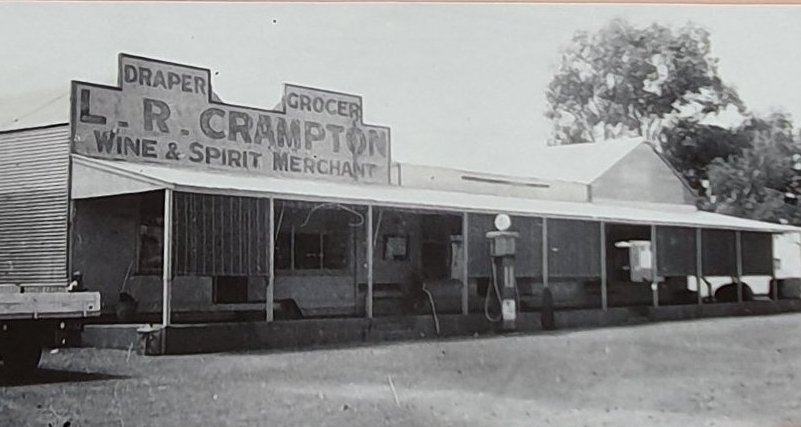
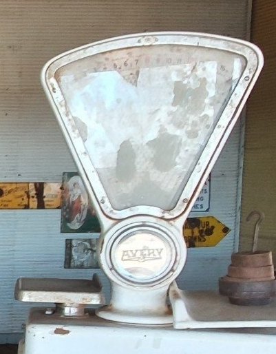
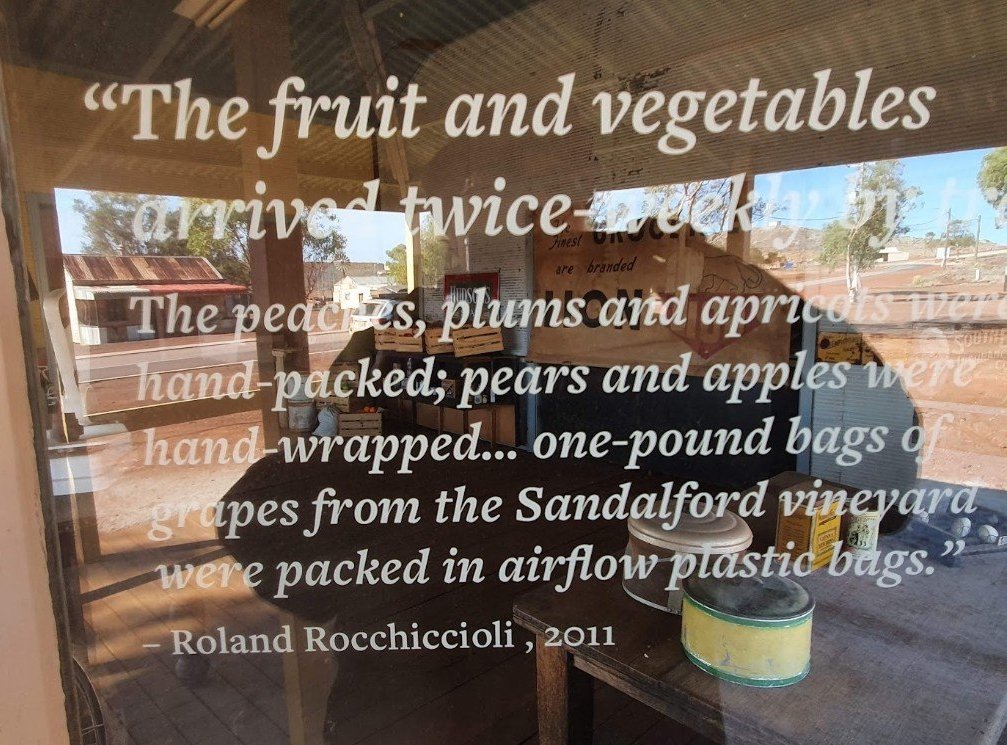
MAZZA’S STORE – “Mazza’s Store was a ‘one-stop shop which supplied all household basics, plus a range of imported items sought by the migrant community. All goods arrived by rail and whenever the train arrived- either six in the morning or at midnight – the store would open to process mail and pack and sell the fresh produce.”
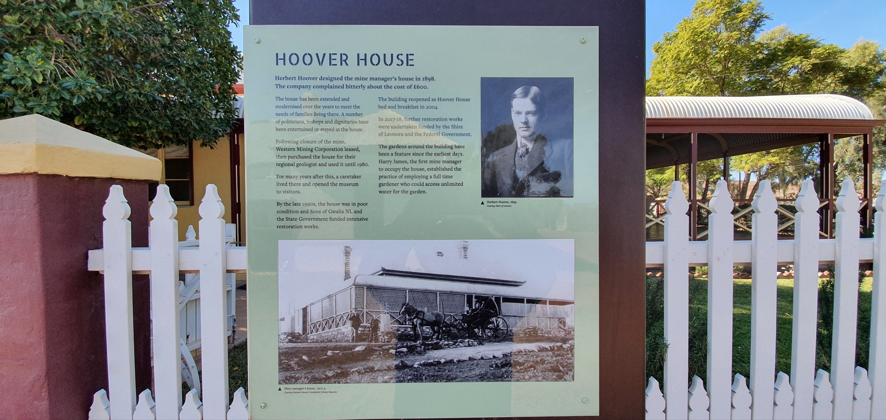
The first mine manager was a young American mining engineer named Herbert Hoover, who later became the 31st President of the United States. The mine manager’s house Hoover designed and which bears his name stands on the summit of “Staff Hill” in the Museum Complex. The Gwalia Museum’s extensive collection of objects, documents and photographs which sketch the history of the mine and showcase the diverse cultures and commercial and domestic life that created Gwalia’s enduring legacy is actually housed in the old mine administration buildings. Next to them is Australia’s only surviving timber incline headframe.
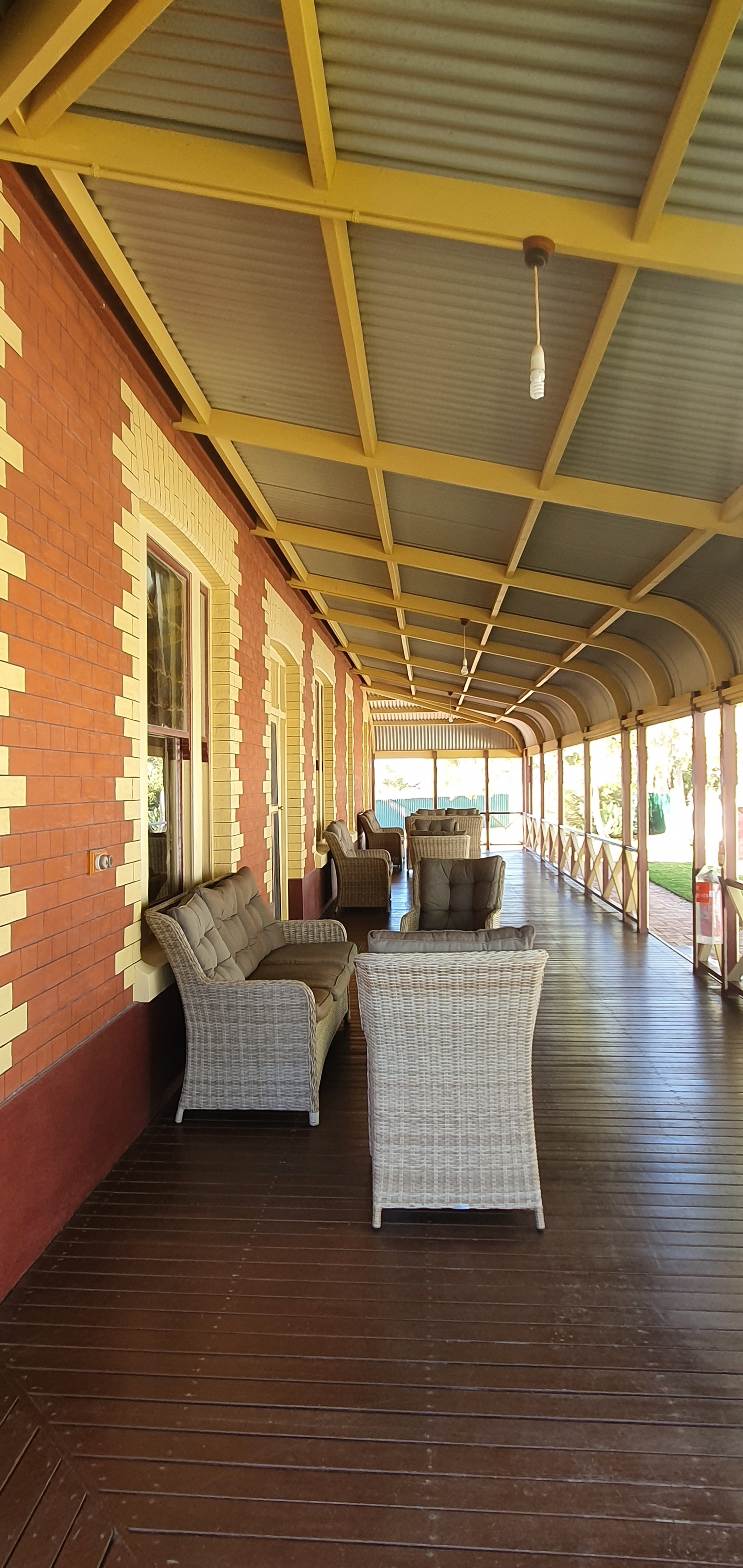
At the top of the hill you come to Hoover House which is now a bed and breakfast and function centre. It is open to the public and there is a lovely little Cafe where we indulged in a yummy afternoon tea. The house sits in beautifully manicured lawns and gardens and overlooks the open pit of the modern working gold mine.
We highly recommend allowing a couple of days to explore this townsite and museum. It is fascinating and full of so much history.
The town of Menzies, 730kilometres east of Perth and 133 kilometres north-northwest of Kalgoorlie, is one of Western Australia’s most historic goldrush towns. However, Aboriginal people have lived in this area for many thousands of years. The local group is the Kaburn Bardu.
The Menzies goldrush boomed during the 1890s. On the 1 October 1894 a claim was registered, Lease No. 1380 in the name of LR Menzie and Sir George Shenton, and Lease No. 1381 for LR Menzie and RF Scholl. These became the Lady Shenton and Florence mines and the place Menzies. The townsite was gazetted in August 1895.
Our knowledge of Menzies was more to do with it being the closest town to Lake Ballard, home to the statues of Sir Antony Gormley. We had wanted to visit this area ever since we first heard about them. We booked into the Menzies Caravan Park for three nights. It was a lovely park with great drive through sites and very clean amenities. The Menzies pub was across the road and on our first night we had a drink and watched the football.
Aboriginal people have been living near or visiting Lake Ballard for well over 10,000 years. Spiritually, Lake Ballard is intimately associated with a ‘Seven Sisters’ dreaming story.
It involves the ‘Sisters’ on one of their nightly exploits. They were cruising across the sky and far below they saw a lake, and decided to go down and play for a while on its surface. They did this, but soon a man started chasing them, very keen to catch the youngest sister. Very frightened, to escape the man, they had to hide.
Today, many of the features of the lake and its surrounds are testament to the identity of the Seven Sisters, the ‘chase’ they endured, and the hiding places where they found safety.
In 2002, Paddy Walker, an elder of the Wangkatha people, was standing at the south-western edge of what we now call Lake Ballard, explaining “that island right in front of us, the largest of the islands, that is the oldest of the sisters.
Sir Antony Gormley is probably most famous for his huge and beautiful Angel of the North statue in Gateshead, in Tyne and Wear, England. He was commissioned by the Perth International Arts Festival to generate a work for its 50th anniversary in 2003. He travelled to the tiny hamlet of Menzies and persuaded 51 locals (and a few drop-ins) to strip naked. He then digitally scanned their bodies, made life-size moulds and then cast them in stainless-steel alloy. The 51 sculptures stand scattered over 10 square kilometres of the Lake Ballard salt lake.
Our visit to Lake Ballard would have to be one of the hilights of our five years of travel. Quite often when you are looking forward with great excitement to seeing a long awaited bucket list item, the reality can be so different from the imagined. Not here, this was far and away so much better than we expected. We were fortunate with the weather being sunny with bright blue sky but not overly hot. As we got out of the car, the Lake showed a brilliant white shimmer, dotted with the sculptures and you immediately felt a sense of awe and wonder. The colours were so vivid and walking out on the salt plain, the ground popped and crackled underfoot with the salt crystals. Every now and then, there was a squelching sound as your foot hit a very soft spot and went through to the mud underneath. We tended to walk in silence as we wandered from statue to statue. There was no way we could walk to all 51 of them but we covered quite a few. Ray managed to walk to the top of the island and Jude got half way up. An amazing 360 degree view of the lake and surrounding area. Please do yourself a favour and visit this iconic location. Just don’t go in the height of summer!